Magill geodata
Magill (South Australia) is a section of populated place; located in Australia in Australia/Adelaide (GMT+10.5) time zone. With population of 8,690 people, there are 735 cities with bigger population in this country. Compared to other cities in Australia, 68.5% of cities are located further ↑North; 78.8% of cities are located further →East and 73.5% of cities have lower elevation than Magill. Note1


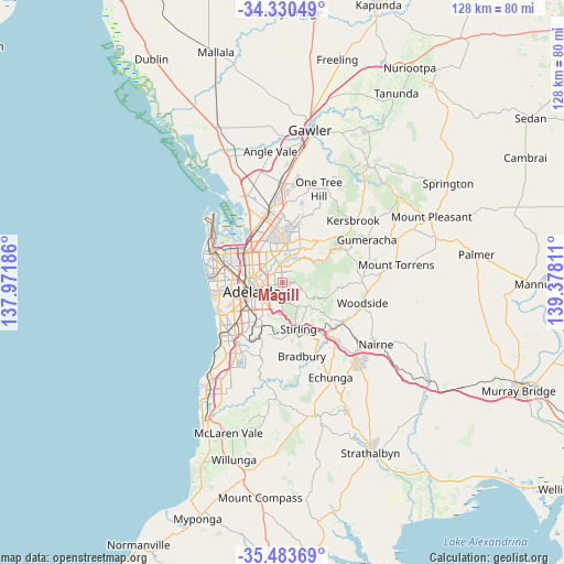
Magill GPS coordinates[2]
34° 54' 32.796" South, 138° 40' 29.928" East
| Map corner | latitude | longitude |
|---|---|---|
| Upper-left | -34.33049°, | 137.97186° |
| Center: | -34.90911°, | 138.67498° |
| Lower-right: | -35.48369°, | 139.37811° |
| Map W x H: | 128.2×128.2 km | = 79.7×79.7mi |
| max Lat: | -10.58257° ⇑68.5% North |
| Magill: | -34.90911° |
| min Lat: | ⇓31.5% South -43.31423° |
| min Long | Magill | max Long |
| 113.53327° | 138.67498° | 153.61246° |
| W 21.2%⇐ | ⇒78.8% E |
Elevation
Elevation of Magill is 120 m = 394 ft, and this is 2 m = 7 ft below average elevation for this country.
| Max E: |
1715 m = 5627 ft | 26.5% |
| Avg. | 122 m = 400 ft | |
| Magill | 120 m = 394 ft | |
Min E: |
-2 m = -7 ft | 73.5% |
See also: Australia elevation on elevation.city.
Geographical zone
Magill is located in South temperate zone (between Tropic of Capricorn and the Antarctic Circle). Distance of this Southern Tropic circle is 1275.6 km =792.6 mi to North.| Distance of | km | miles | from Magill |
|---|---|---|---|
| Equator | 3881.5 | 2411.9 | to North |
| Tropic Capricorn | 1275.6 | 792.6 | to North |
| Antarctic Circle | 3519.6 | 2187 | to South |
| South Pole | 6125.5 | 3806.2 | to South |


Nearby cities:
15 places around Magill: (largest is in red/bold)
• Auldana
1.5 km =0.9 mi,  132°
132°
• Erindale
2.3 km =1.4 mi,  207°
207°
• Firle
2 km =1.2 mi,  284°
284°
• Glynde
2.5 km =1.6 mi,  305°
305°
• Hectorville
2.4 km =1.5 mi,  323°
323°
• Kensington Gardens
2.2 km =1.4 mi, 213°
• Kensington Park
2.3 km =1.4 mi,  236°
236°
• Leabrook
2.7 km =1.7 mi, 213°
• Rosslyn Park
1.4 km =0.9 mi,  177°
177°
• Rostrevor
2.3 km =1.4 mi,  42°
42°
• St Morris
2 km =1.2 mi,  263°
263°
• Teringie
2.6 km =1.6 mi,  103°
103°
• Tranmere
1.2 km =0.7 mi,  288°
288°
• Wattle Park
1.8 km =1.1 mi, 179°
• Woodforde
1.4 km =0.9 mi,  71°
71°
Sources, notices
• [Note1] Compared only with cities in Australia existing in our database
• [Src1] Map data: © OpenStreetMap contributors (CC-BY-SA)
• [Src2] Other city data from geonames.org with taken over terms of usage.
• [Src3] Geographical zone / Annual Mean Temperature by Robert A. Rohde @ Wikipedia
