Brockman geodata
Brockman (Western Australia) is a section of populated place; located in Australia in Australia/Perth (GMT+8) time zone. With population of 1,039 people, there are 3768 cities with bigger population in this country. Compared to other cities in Australia, 90% of cities are located further ↓South; 100% of cities are located further →East and 96.8% of cities have higher elevation than Brockman. Note1


Brockman GPS coordinates[2]
24° 52' 52.536" South, 113° 39' 13.14" East
| Map corner | latitude | longitude |
|---|---|---|
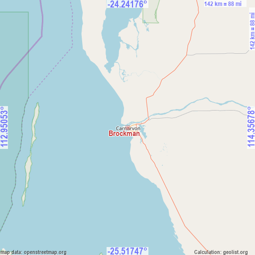
| Upper-left | -24.24176°, | 112.95053° |
| Center: | -24.88126°, | 113.65365° |
| Lower-right: | -25.51747°, | 114.35678° |
| Map W x H: | 141.8×141.8 km | = 88.1×88.1mi |
| max Lat: | -10.58257° ⇑10% North |
| Brockman: | -24.88126° |
| min Lat: | ⇓90% South -43.31423° |
| min Long | Brockman | max Long |
| 113.53327° | 113.65365° | 153.61246° |
| W 0%⇐ | ⇒100% E |
Elevation
Elevation of Brockman is 5 m = 16 ft, and this is 117 m = 384 ft below average elevation for this country.
| Max E: |
1715 m = 5627 ft | 96.8% |
| Avg. | 122 m = 400 ft | |
| Brockman | 5 m = 16 ft | |
Min E: |
-2 m = -7 ft | 3.2% |
See also: Australia elevation on elevation.city.
Geographical zone
Brockman is located in South temperate zone (between Tropic of Capricorn and the Antarctic Circle). Distance of this Southern Tropic circle is 160.6 km =99.8 mi to North.| Distance of | km | miles | from Brockman |
|---|---|---|---|
| Equator | 2766.5 | 1719 | to North |
| Tropic Capricorn | 160.6 | 99.8 | to North |
| Antarctic Circle | 4634.6 | 2879.8 | to South |
| South Pole | 7240.5 | 4499 | to South |


Nearby cities:
15 places around Brockman: (largest is in red/bold)
• Carnarvon
0.4 km =0.2 mi,  112°
112°
• Coral Bay
193.9 km =120.5 mi,  3°
3°
• Denham
116.9 km =72.6 mi,  185°
185°
• Drummond Cove
432.3 km =268.6 mi,  167°
167°
• East Carnarvon
3.1 km =1.9 mi,  51°
51°
• Exmouth
331.5 km =206 mi,  8°
8°
• Glenfield
434.5 km =270 mi, 167°
• Kalbarri
318.7 km =198 mi, 170°
• Kingsford
4.6 km =2.9 mi,  65°
65°
• Morgantown
0.7 km =0.4 mi, 45°
• North West Cape
330.8 km =205.5 mi, 6°
• Northampton
397.9 km =247.2 mi, 165°
• Onslow
390.2 km =242.5 mi,  22°
22°
• South Carnarvon
1.4 km =0.9 mi,  160°
160°
• Sunset Beach
437.4 km =271.8 mi, 167°
Sources, notices
• [Note1] Compared only with cities in Australia existing in our database
• [Src1] Map data: © OpenStreetMap contributors (CC-BY-SA)
• [Src2] Other city data from geonames.org with taken over terms of usage.
• [Src3] Geographical zone / Annual Mean Temperature by Robert A. Rohde @ Wikipedia
