Highvale geodata
Highvale (Queensland) is a section of populated place; located in Australia in Australia/Brisbane (GMT+10) time zone. With population of 1,726 people, there are 3091 cities with bigger population in this country. Compared to other cities in Australia, 84.1% of cities are located further ↓South; 87% of cities are located further ←West and 76.8% of cities have lower elevation than Highvale. Note1


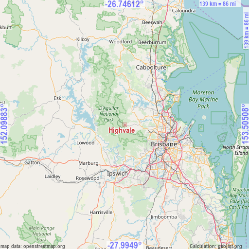
Highvale GPS coordinates[2]
27° 22' 20.172" South, 152° 48' 7.02" East
| Map corner | latitude | longitude |
|---|---|---|
| Upper-left | -26.74612°, | 152.09883° |
| Center: | -27.37227°, | 152.80195° |
| Lower-right: | -27.9949°, | 153.50508° |
| Map W x H: | 138.9×138.9 km | = 86.3×86.3mi |
| max Lat: | -10.58257° ⇑15.9% North |
| Highvale: | -27.37227° |
| min Lat: | ⇓84.1% South -43.31423° |
| min Long | Highvale | max Long |
| 113.53327° | 152.80195° | 153.61246° |
| W 87%⇐ | ⇒13% E |
Elevation
Elevation of Highvale is 146 m = 479 ft, and this is 24 m = 79 ft above average elevation for this country.
| Max E: |
1715 m = 5627 ft | 23.2% |
| Highvale | 146 m 479 ft | |
| Avg. | 122 m = 400 ft | |
Min E: |
-2 m = -7 ft | 76.8% |
See also: Australia elevation on elevation.city.
Geographical zone
Highvale is located in South temperate zone (between Tropic of Capricorn and the Antarctic Circle). Distance of this Southern Tropic circle is 437.6 km =271.9 mi to North.| Distance of | km | miles | from Highvale |
|---|---|---|---|
| Equator | 3043.5 | 1891.1 | to North |
| Tropic Capricorn | 437.6 | 271.9 | to North |
| Antarctic Circle | 4357.7 | 2707.7 | to South |
| South Pole | 6963.6 | 4327 | to South |


Nearby cities:
15 places around Highvale: (largest is in red/bold)
• Camp Mountain
8.6 km =5.3 mi,  110°
110°
• Cashmere
13.3 km =8.3 mi,  51°
51°
• Cedar Creek
4.6 km =2.9 mi,  21°
21°
• Clear Mountain
10.9 km =6.8 mi, 47°
• Closeburn
8 km =5 mi, 50°
• Draper
10.6 km =6.6 mi,  78°
78°
• Ferny Grove
13.5 km =8.4 mi,  103°
103°
• Ferny Hills
13.6 km =8.5 mi, 101°
• Mount Samson
9.3 km =5.8 mi,  30°
30°
• Samford
8.4 km =5.2 mi,  90°
90°
• Samford Valley
6.4 km =4 mi, 90°
• Samson Vale
12.7 km =7.9 mi, 22°
• Upper Brookfield
12.3 km =7.6 mi,  148°
148°
• Upper Kedron
12.5 km =7.8 mi, 114°
• Wights Mountain
5.8 km =3.6 mi, 113°
Sources, notices
• [Note1] Compared only with cities in Australia existing in our database
• [Src1] Map data: © OpenStreetMap contributors (CC-BY-SA)
• [Src2] Other city data from geonames.org with taken over terms of usage.
• [Src3] Geographical zone / Annual Mean Temperature by Robert A. Rohde @ Wikipedia
