Zottegem geodata
Zottegem (Flanders) is a populated place; located in Belgium in Europe/Brussels (GMT+2) time zone. With population of 24,434 people, there are 83 cities with bigger population in this country. Compared to other cities in Belgium, 56.7% of cities are located further ↓South; 79.4% of cities are located further →East and 55.4% of cities have lower elevation than Zottegem. Note1
Administrative division(s):
- Level 1: Flanders
- Level 2: Provincie Oost-Vlaanderen
- Level 3: Arrondissement Aalst
- Level 4: Zottegem


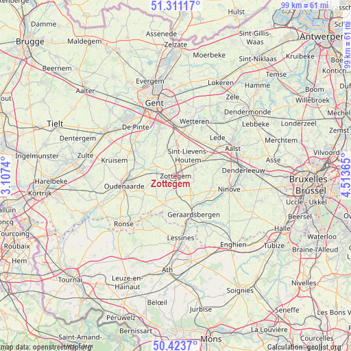
Zottegem GPS coordinates[2]
50° 52' 10.38" North, 3° 48' 37.872" East
| Map corner | latitude | longitude |
|---|---|---|
| Upper-left | 51.31117°, | 3.1074° |
| Center: | 50.86955°, | 3.81052° |
| Lower-right: | 50.4237°, | 4.51365° |
| Map W x H: | 98.7×98.7 km | = 61.3×61.3mi |
| max Lat: | 51.46791° ⇑43.3% North |
| Zottegem: | 50.86955° |
| min Lat: | ⇓56.7% South 49.53771° |
| min Long | Zottegem | max Long |
| 2.59368° | 3.81052° | 6.25749° |
| W 20.6%⇐ | ⇒79.4% E |
Elevation
Elevation of Zottegem is 63 m = 207 ft, and this is 36.5 m = 120 ft below average elevation for this country.
| Max E: |
582 m = 1909 ft | 44.6% |
| Avg. | 99.5 m = 326 ft | |
| Zottegem | 63 m = 207 ft | |
Min E: |
1 m = 3 ft | 55.4% |
See also: Belgium elevation on elevation.city.
Geographical zone
Zottegem is located in North temperate zone (between Tropic of Cancer and the Arctic Circle). Distance of this North polar circle is 1745 km =1084.3 mi to North.| Distance of | km | miles | from Zottegem |
|---|---|---|---|
| North Pole | 4350.9 | 2703.5 | to North |
| Arctic Circle | 1745 | 1084.3 | to North |
| Tropic Cancer | 3050.2 | 1895.3 | to South |
| Equator | 5656.2 | 3514.6 | to South |


Nearby cities:
15 places around Zottegem: (largest is in red/bold)
• Flobecq
15.5 km =9.6 mi,  198°
198°
• Gavere
12.4 km =7.7 mi,  302°
302°
• Geraardsbergen
11.8 km =7.3 mi,  154°
154°
• Haaltert
14 km =8.7 mi,  72°
72°
• Herzele
5.9 km =3.7 mi, 71°
• Melle
14.8 km =9.2 mi,  358°
358°
• Merelbeke
14.6 km =9.1 mi,  342°
342°
• Ninove
15.9 km =9.9 mi,  107°
107°
• Oosterzele
9.3 km =5.8 mi,  354°
354°
• Oudenaarde
14.3 km =8.9 mi,  262°
262°
• Perre
4.2 km =2.6 mi,  58°
58°
• Sint-Lievens-Houtem
6.7 km =4.2 mi,  33°
33°
• Sint-Maria-Lierde
6.1 km =3.8 mi,  157°
157°
• Wetteren
15.9 km =9.9 mi,  18°
18°
• Zingem
11.7 km =7.3 mi,  289°
289°
Sources, notices
• [Note1] Compared only with cities in Belgium existing in our database
• [Src1] Map data: © OpenStreetMap contributors (CC-BY-SA)
• [Src2] Other city data from geonames.org with taken over terms of usage.
• [Src3] Geographical zone / Annual Mean Temperature by Robert A. Rohde @ Wikipedia
