Gavere geodata
Gavere (Flanders) is a populated place; located in Belgium in Europe/Brussels (GMT+2) time zone. With population of 11,888 people, there are 253 cities with bigger population in this country. Compared to other cities in Belgium, 63.7% of cities are located further ↓South; 82.9% of cities are located further →East and 65.9% of cities have higher elevation than Gavere. Note1
Administrative division(s):
- Level 1: Flanders
- Level 2: Provincie Oost-Vlaanderen
- Level 3: Arrondissement Gent
- Level 4: Gavere


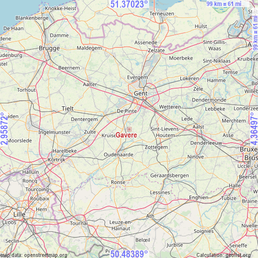
Gavere GPS coordinates[2]
50° 55' 45.012" North, 3° 39' 42.624" East
| Map corner | latitude | longitude |
|---|---|---|
| Upper-left | 51.37023°, | 2.95872° |
| Center: | 50.92917°, | 3.66184° |
| Lower-right: | 50.48389°, | 4.36497° |
| Map W x H: | 98.6×98.5 km | = 61.3×61.2mi |
| max Lat: | 51.46791° ⇑36.3% North |
| Gavere: | 50.92917° |
| min Lat: | ⇓63.7% South 49.53771° |
| min Long | Gavere | max Long |
| 2.59368° | 3.66184° | 6.25749° |
| W 17.1%⇐ | ⇒82.9% E |
Elevation
Elevation of Gavere is 25 m = 82 ft, and this is 74.5 m = 244 ft below average elevation for this country.
| Max E: |
582 m = 1909 ft | 65.9% |
| Avg. | 99.5 m = 326 ft | |
| Gavere | 25 m = 82 ft | |
Min E: |
1 m = 3 ft | 34.1% |
See also: Belgium elevation on elevation.city.
Geographical zone
Gavere is located in North temperate zone (between Tropic of Cancer and the Arctic Circle). Distance of this North polar circle is 1738.4 km =1080.2 mi to North.| Distance of | km | miles | from Gavere |
|---|---|---|---|
| North Pole | 4344.3 | 2699.4 | to North |
| Arctic Circle | 1738.4 | 1080.2 | to North |
| Tropic Cancer | 3056.9 | 1899.5 | to South |
| Equator | 5662.8 | 3518.7 | to South |


Nearby cities:
15 places around Gavere: (largest is in red/bold)
• De Pinte
7.2 km =4.5 mi,  351°
351°
• Deinze
10.9 km =6.8 mi,  302°
302°
• Gent
14 km =8.7 mi,  15°
15°
• Kruishoutem
10 km =6.2 mi,  252°
252°
• Ledeberg
13.5 km =8.4 mi,  25°
25°
• Melle
12.9 km =8 mi,  50°
50°
• Merelbeke
9.4 km =5.8 mi,  39°
39°
• Nazareth
5.6 km =3.5 mi, 303°
• Nevele
14.3 km =8.9 mi,  325°
325°
• Oosterzele
9.9 km =6.2 mi,  74°
74°
• Oudenaarde
9.4 km =5.8 mi,  203°
203°
• Sint-Lievens-Houtem
14.1 km =8.8 mi,  94°
94°
• Sint-Martens-Latem
9.6 km =6 mi, 349°
• Zingem
2.9 km =1.8 mi,  192°
192°
• Zottegem
12.4 km =7.7 mi,  122°
122°
Sources, notices
• [Note1] Compared only with cities in Belgium existing in our database
• [Src1] Map data: © OpenStreetMap contributors (CC-BY-SA)
• [Src2] Other city data from geonames.org with taken over terms of usage.
• [Src3] Geographical zone / Annual Mean Temperature by Robert A. Rohde @ Wikipedia
