Sint-Maria-Lierde geodata
Sint-Maria-Lierde (Flanders) is a populated place; located in Belgium in Europe/Brussels (GMT+2) time zone. With population of 6,449 people, there are 412 cities with bigger population in this country. Compared to other cities in Belgium, 51.6% of cities are located further ↓South; 78.7% of cities are located further →East and 52.7% of cities have higher elevation than Sint-Maria-Lierde. Note1
Administrative division(s):
- Level 1: Flanders
- Level 2: Provincie Oost-Vlaanderen
- Level 3: Arrondissement Oudenaarde
- Level 4: Lierde


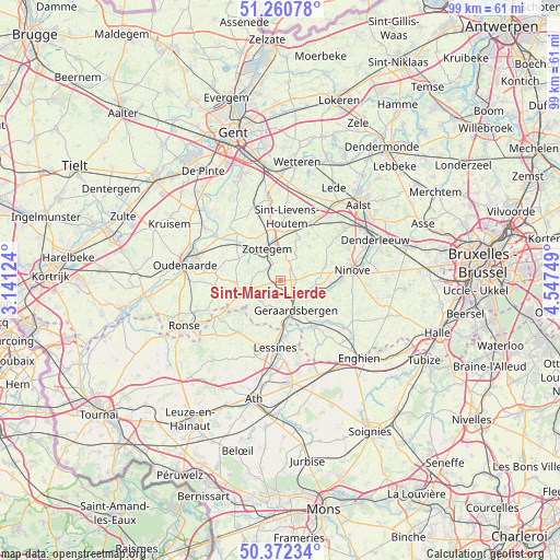
Sint-Maria-Lierde GPS coordinates[2]
50° 49' 7.212" North, 3° 50' 39.696" East
| Map corner | latitude | longitude |
|---|---|---|
| Upper-left | 51.26078°, | 3.14124° |
| Center: | 50.81867°, | 3.84436° |
| Lower-right: | 50.37234°, | 4.54749° |
| Map W x H: | 98.8×98.8 km | = 61.4×61.4mi |
| max Lat: | 51.46791° ⇑48.4% North |
| Sint-Maria-Lierde: | 50.81867° |
| min Lat: | ⇓51.6% South 49.53771° |
| min Long | Sint-Maria-Lier | max Long |
| 2.59368° | 3.84436° | 6.25749° |
| W 21.3%⇐ | ⇒78.7% E |
Elevation
Elevation of Sint-Maria-Lierde is 45 m = 148 ft, and this is 54.5 m = 179 ft below average elevation for this country.
| Max E: |
582 m = 1909 ft | 52.7% |
| Avg. | 99.5 m = 326 ft | |
| Sint-Maria-Lierde | 45 m = 148 ft | |
Min E: |
1 m = 3 ft | 47.3% |
See also: Belgium elevation on elevation.city.
Geographical zone
Sint-Maria-Lierde is located in North temperate zone (between Tropic of Cancer and the Arctic Circle). Distance of this North polar circle is 1750.7 km =1087.8 mi to North.| Distance of | km | miles | from Sint-Maria-Lierde |
|---|---|---|---|
| North Pole | 4356.6 | 2707.1 | to North |
| Arctic Circle | 1750.7 | 1087.8 | to North |
| Tropic Cancer | 3044.6 | 1891.8 | to South |
| Equator | 5650.5 | 3511.1 | to South |


Nearby cities:
15 places around Sint-Maria-Lierde: (largest is in red/bold)
• Ellezelles
14.8 km =9.2 mi,  231°
231°
• Flobecq
11.7 km =7.3 mi,  219°
219°
• Galmaarden
11.5 km =7.1 mi,  128°
128°
• Geraardsbergen
5.7 km =3.5 mi,  152°
152°
• Haaltert
14.7 km =9.1 mi,  48°
48°
• Herne
17 km =10.6 mi, 128°
• Herzele
8.2 km =5.1 mi,  22°
22°
• Lessines
12 km =7.5 mi,  182°
182°
• Ninove
12.8 km =8 mi,  85°
85°
• Oosterzele
15.2 km =9.4 mi,  347°
347°
• Oudenaarde
16.9 km =10.5 mi,  282°
282°
• Perre
7.9 km =4.9 mi,  8°
8°
• Sint-Lievens-Houtem
11.3 km =7 mi, 6°
• Zingem
16.4 km =10.2 mi,  305°
305°
• Zottegem
6.1 km =3.8 mi,  337°
337°
Sources, notices
• [Note1] Compared only with cities in Belgium existing in our database
• [Src1] Map data: © OpenStreetMap contributors (CC-BY-SA)
• [Src2] Other city data from geonames.org with taken over terms of usage.
• [Src3] Geographical zone / Annual Mean Temperature by Robert A. Rohde @ Wikipedia
