Cerfontaine geodata
Cerfontaine (Wallonia) is a populated place; located in Belgium in Europe/Brussels (GMT+2) time zone. With population of 4,500 people, there are 470 cities with bigger population in this country. Compared to other cities in Belgium, 92.2% of cities are located further ↑North; 59.2% of cities are located further →East and 83.9% of cities have lower elevation than Cerfontaine. Note1
Administrative division(s):
- Level 1: Wallonia
- Level 2: Province de Namur
- Level 3: Arrondissement de Philippeville
- Level 4: Cerfontaine


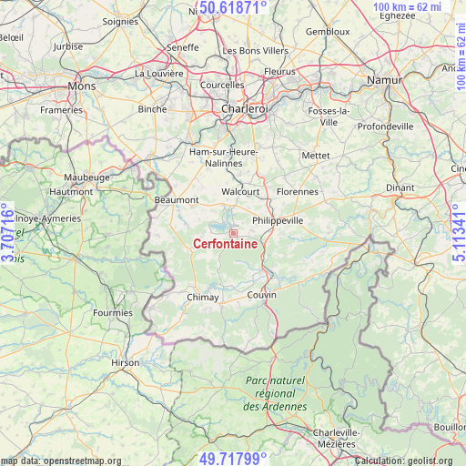
Cerfontaine GPS coordinates[2]
50° 10' 13.692" North, 4° 24' 37.008" East
| Map corner | latitude | longitude |
|---|---|---|
| Upper-left | 50.61871°, | 3.70716° |
| Center: | 50.17047°, | 4.41028° |
| Lower-right: | 49.71799°, | 5.11341° |
| Map W x H: | 100.2×100.1 km | = 62.3×62.2mi |
| max Lat: | 51.46791° ⇑92.2% North |
| Cerfontaine: | 50.17047° |
| min Lat: | ⇓7.8% South 49.53771° |
| min Long | Cerfontaine | max Long |
| 2.59368° | 4.41028° | 6.25749° |
| W 40.8%⇐ | ⇒59.2% E |
Elevation
Elevation of Cerfontaine is 218 m = 715 ft, and this is 118.5 m = 389 ft above average elevation for this country.
| Max E: |
582 m = 1909 ft | 16.1% |
| Cerfontaine | 218 m 715 ft | |
| Avg. | 99.5 m = 326 ft | |
Min E: |
1 m = 3 ft | 83.9% |
See also: Belgium elevation on elevation.city.
Geographical zone
Cerfontaine is located in North temperate zone (between Tropic of Cancer and the Arctic Circle). Distance of this North polar circle is 1822.7 km =1132.6 mi to North.| Distance of | km | miles | from Cerfontaine |
|---|---|---|---|
| North Pole | 4428.6 | 2751.8 | to North |
| Arctic Circle | 1822.7 | 1132.6 | to North |
| Tropic Cancer | 2972.5 | 1847 | to South |
| Equator | 5578.4 | 3466.3 | to South |


Nearby cities:
15 places around Cerfontaine: (largest is in red/bold)
• Beaumont
14.2 km =8.8 mi,  301°
301°
• Chimay
15.1 km =9.4 mi,  206°
206°
• Couvin
14.4 km =8.9 mi,  155°
155°
• Doische
23.5 km =14.6 mi,  100°
100°
• Erquelinnes
26.1 km =16.2 mi,  305°
305°
• Florennes
16.6 km =10.3 mi,  57°
57°
• Froidchapelle
6.3 km =3.9 mi,  249°
249°
• Gerpinnes
20.4 km =12.7 mi,  24°
24°
• Lobbes
22.7 km =14.1 mi,  333°
333°
• Merbes-le-Château
24.4 km =15.2 mi, 314°
• Mettet
24.5 km =15.2 mi,  46°
46°
• Momignies
23.7 km =14.7 mi,  227°
227°
• Philippeville
9.9 km =6.2 mi,  73°
73°
• Thuin
20.7 km =12.9 mi, 334°
• Walcourt
9.5 km =5.9 mi,  11°
11°
Sources, notices
• [Note1] Compared only with cities in Belgium existing in our database
• [Src1] Map data: © OpenStreetMap contributors (CC-BY-SA)
• [Src2] Other city data from geonames.org with taken over terms of usage.
• [Src3] Geographical zone / Annual Mean Temperature by Robert A. Rohde @ Wikipedia
