Sint-Martens-Lennik geodata
Sint-Martens-Lennik (Flanders) is a populated place; located in Belgium in Europe/Brussels (GMT+2) time zone. With population of 8,818 people, there are 342 cities with bigger population in this country. Compared to other cities in Belgium, 51.1% of cities are located further ↓South; 69% of cities are located further →East and 53.2% of cities have lower elevation than Sint-Martens-Lennik. Note1
Administrative division(s):
- Level 1: Flanders
- Level 2: Provincie Vlaams-Brabant
- Level 3: Arrondissement Halle-Vilvoorde
- Level 4: Lennik


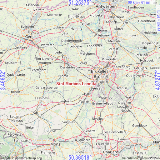
Sint-Martens-Lennik GPS coordinates[2]
50° 48' 41.688" North, 4° 10' 10.74" East
| Map corner | latitude | longitude |
|---|---|---|
| Upper-left | 51.25375°, | 3.46652° |
| Center: | 50.81158°, | 4.16965° |
| Lower-right: | 50.36518°, | 4.87277° |
| Map W x H: | 98.8×98.8 km | = 61.4×61.4mi |
| max Lat: | 51.46791° ⇑48.9% North |
| Sint-Martens-Lennik: | 50.81158° |
| min Lat: | ⇓51.1% South 49.53771° |
| min Long | Sint-Martens-Le | max Long |
| 2.59368° | 4.16965° | 6.25749° |
| W 31%⇐ | ⇒69% E |
Elevation
Elevation of Sint-Martens-Lennik is 57 m = 187 ft, and this is 42.5 m = 139 ft below average elevation for this country.
| Max E: |
582 m = 1909 ft | 46.8% |
| Avg. | 99.5 m = 326 ft | |
| Sint-Martens-Lennik | 57 m = 187 ft | |
Min E: |
1 m = 3 ft | 53.2% |
See also: Belgium elevation on elevation.city.
Geographical zone
Sint-Martens-Lennik is located in North temperate zone (between Tropic of Cancer and the Arctic Circle). Distance of this North polar circle is 1751.5 km =1088.3 mi to North.| Distance of | km | miles | from Sint-Martens-Lennik |
|---|---|---|---|
| North Pole | 4357.3 | 2707.5 | to North |
| Arctic Circle | 1751.5 | 1088.3 | to North |
| Tropic Cancer | 3043.8 | 1891.3 | to South |
| Equator | 5649.7 | 3510.6 | to South |


Nearby cities:
15 places around Sint-Martens-Lennik: (largest is in red/bold)
• Asse
11.1 km =6.9 mi,  10°
10°
• Beersel
10.5 km =6.5 mi,  118°
118°
• Denderleeuw
10.5 km =6.5 mi,  321°
321°
• Dilbeek
7.5 km =4.7 mi,  57°
57°
• Drogenbos
10.5 km =6.5 mi,  104°
104°
• Gooik
4.4 km =2.7 mi,  244°
244°
• Halle
9.8 km =6.1 mi,  152°
152°
• Ledeberg
6.6 km =4.1 mi,  302°
302°
• Lennik
0.6 km =0.4 mi, 241°
• Liedekerke
8.6 km =5.3 mi, 317°
• Linkebeek
12.7 km =7.9 mi,  112°
112°
• Ninove
10.2 km =6.3 mi,  280°
280°
• Pepingen
5.9 km =3.7 mi,  186°
186°
• Sint-Pieters-Leeuw
6.3 km =3.9 mi, 124°
• Ternat
6.1 km =3.8 mi,  358°
358°
Sources, notices
• [Note1] Compared only with cities in Belgium existing in our database
• [Src1] Map data: © OpenStreetMap contributors (CC-BY-SA)
• [Src2] Other city data from geonames.org with taken over terms of usage.
• [Src3] Geographical zone / Annual Mean Temperature by Robert A. Rohde @ Wikipedia
