Nijlen geodata
Nijlen (Flanders) is a populated place; located in Belgium in Europe/Brussels (GMT+2) time zone. With population of 20,792 people, there are 112 cities with bigger population in this country. Compared to other cities in Belgium, 86.8% of cities are located further ↓South; 54.2% of cities are located further ←West and 93.3% of cities have higher elevation than Nijlen. Note1
Administrative division(s):
- Level 1: Flanders
- Level 2: Provincie Antwerpen
- Level 3: Arrondissement Mechelen
- Level 4: Nijlen


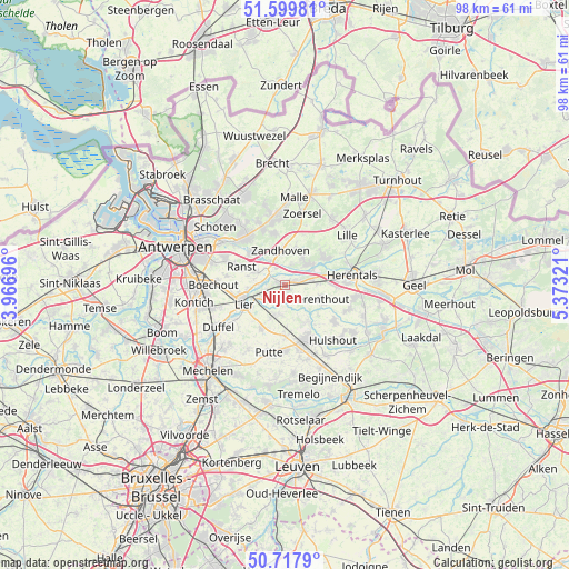
Nijlen GPS coordinates[2]
51° 9' 39.456" North, 4° 40' 12.288" East
| Map corner | latitude | longitude |
|---|---|---|
| Upper-left | 51.59981°, | 3.96696° |
| Center: | 51.16096°, | 4.67008° |
| Lower-right: | 50.7179°, | 5.37321° |
| Map W x H: | 98.1×98.1 km | = 61×61mi |
| max Lat: | 51.46791° ⇑13.2% North |
| Nijlen: | 51.16096° |
| min Lat: | ⇓86.8% South 49.53771° |
| min Long | Nijlen | max Long |
| 2.59368° | 4.67008° | 6.25749° |
| W 54.2%⇐ | ⇒45.8% E |
Elevation
Elevation of Nijlen is 7 m = 23 ft, and this is 92.5 m = 303 ft below average elevation for this country.
| Max E: |
582 m = 1909 ft | 93.3% |
| Avg. | 99.5 m = 326 ft | |
| Nijlen | 7 m = 23 ft | |
Min E: |
1 m = 3 ft | 6.7% |
See also: Belgium elevation on elevation.city.
Geographical zone
Nijlen is located in North temperate zone (between Tropic of Cancer and the Arctic Circle). Distance of this North polar circle is 1712.6 km =1064.2 mi to North.| Distance of | km | miles | from Nijlen |
|---|---|---|---|
| North Pole | 4318.5 | 2683.4 | to North |
| Arctic Circle | 1712.6 | 1064.2 | to North |
| Tropic Cancer | 3082.6 | 1915.4 | to South |
| Equator | 5688.6 | 3534.7 | to South |


Nearby cities:
15 places around Nijlen: (largest is in red/bold)
• Berlaar
4.9 km =3 mi,  189°
189°
• Boechout
12.4 km =7.7 mi,  269°
269°
• Grobbendonk
5.6 km =3.5 mi,  54°
54°
• Heist-op-den-Berg
10.3 km =6.4 mi,  156°
156°
• Herentals
11.5 km =7.1 mi,  81°
81°
• Herenthout
6.4 km =4 mi,  111°
111°
• Lier
7.7 km =4.8 mi,  244°
244°
• Lint
12.7 km =7.9 mi,  252°
252°
• Putte
12.2 km =7.6 mi, 192°
• Ranst
8 km =5 mi,  293°
293°
• Schilde
10.8 km =6.7 mi,  325°
325°
• Vorselaar
8.5 km =5.3 mi,  57°
57°
• Wommelgem
11.4 km =7.1 mi,  295°
295°
• Zandhoven
6 km =3.7 mi,  354°
354°
• Zoersel
12.3 km =7.6 mi,  14°
14°
Sources, notices
• [Note1] Compared only with cities in Belgium existing in our database
• [Src1] Map data: © OpenStreetMap contributors (CC-BY-SA)
• [Src2] Other city data from geonames.org with taken over terms of usage.
• [Src3] Geographical zone / Annual Mean Temperature by Robert A. Rohde @ Wikipedia
