Heist-op-den-Berg geodata
Heist-op-den-Berg (Flanders) is a seat of a fourth-order administrative division; located in Belgium in Europe/Brussels (GMT+2) time zone. With population of 37,873 people, there are 28 cities with bigger population in this country. Compared to other cities in Belgium, 78.3% of cities are located further ↓South; 56.1% of cities are located further ←West and 58.1% of cities have higher elevation than Heist-op-den-Berg. Note1
Administrative division(s):
- Level 1: Flanders
- Level 2: Provincie Antwerpen
- Level 3: Arrondissement Mechelen
- Level 4: Heist-op-den-Berg


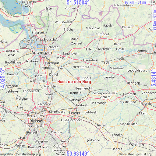
Heist-op-den-Berg GPS coordinates[2]
51° 4' 31.332" North, 4° 43' 41.772" East
| Map corner | latitude | longitude |
|---|---|---|
| Upper-left | 51.51504°, | 4.02515° |
| Center: | 51.07537°, | 4.72827° |
| Lower-right: | 50.63149°, | 5.4314° |
| Map W x H: | 98.2×98.2 km | = 61×61mi |
| max Lat: | 51.46791° ⇑21.7% North |
| Heist-op-den-Berg: | 51.07537° |
| min Lat: | ⇓78.3% South 49.53771° |
| min Long | Heist-op-den-Be | max Long |
| 2.59368° | 4.72827° | 6.25749° |
| W 56.1%⇐ | ⇒43.9% E |
Elevation
Elevation of Heist-op-den-Berg is 36 m = 118 ft, and this is 63.5 m = 208 ft below average elevation for this country.
| Max E: |
582 m = 1909 ft | 58.1% |
| Avg. | 99.5 m = 326 ft | |
| Heist-op-den-Berg | 36 m = 118 ft | |
Min E: |
1 m = 3 ft | 41.9% |
See also: Belgium elevation on elevation.city.
Geographical zone
Heist-op-den-Berg is located in North temperate zone (between Tropic of Cancer and the Arctic Circle). Distance of this North polar circle is 1722.1 km =1070.1 mi to North.| Distance of | km | miles | from Heist-op-den-Berg |
|---|---|---|---|
| North Pole | 4328 | 2689.3 | to North |
| Arctic Circle | 1722.1 | 1070.1 | to North |
| Tropic Cancer | 3073.1 | 1909.5 | to South |
| Equator | 5679 | 3528.8 | to South |


Nearby cities:
15 places around Heist-op-den-Berg: (largest is in red/bold)
• Aarschot
12.4 km =7.7 mi,  142°
142°
• Begijnendijk
7.3 km =4.5 mi,  148°
148°
• Berlaar
6.8 km =4.2 mi,  313°
313°
• Grobbendonk
12.8 km =8 mi,  2°
2°
• Haacht
12.6 km =7.8 mi,  210°
210°
• Herenthout
7.4 km =4.6 mi,  14°
14°
• Herselt
11.1 km =6.9 mi,  103°
103°
• Hulshout
4.4 km =2.7 mi,  91°
91°
• Keerbergen
10.4 km =6.5 mi,  219°
219°
• Lier
12.7 km =7.9 mi,  299°
299°
• Nijlen
10.3 km =6.4 mi,  336°
336°
• Olen
11.9 km =7.4 mi,  50°
50°
• Putte
7.1 km =4.4 mi,  249°
249°
• Tremelo
9.3 km =5.8 mi,  188°
188°
• Westerlo
13.2 km =8.2 mi,  82°
82°
Sources, notices
• [Note1] Compared only with cities in Belgium existing in our database
• [Src1] Map data: © OpenStreetMap contributors (CC-BY-SA)
• [Src2] Other city data from geonames.org with taken over terms of usage.
• [Src3] Geographical zone / Annual Mean Temperature by Robert A. Rohde @ Wikipedia
