Marchovelette geodata
Marchovelette (Wallonia) is a populated place; located in Belgium in Europe/Brussels (GMT+2) time zone. With population of 798 people, there are 544 cities with bigger population in this country. Compared to other cities in Belgium, 75.6% of cities are located further ↑North; 63.5% of cities are located further ←West and 80.7% of cities have lower elevation than Marchovelette. Note1
Administrative division(s):
- Level 1: Wallonia
- Level 2: Province de Namur
- Level 3: Arrondissement de Namur
- Level 4: Fernelmont


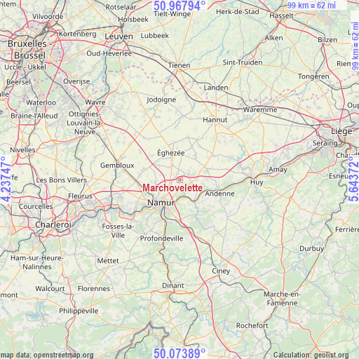
Marchovelette GPS coordinates[2]
50° 31' 22.908" North, 4° 56' 26.124" East
| Map corner | latitude | longitude |
|---|---|---|
| Upper-left | 50.96794°, | 4.23747° |
| Center: | 50.52303°, | 4.94059° |
| Lower-right: | 50.07389°, | 5.64372° |
| Map W x H: | 99.4×99.4 km | = 61.8×61.8mi |
| max Lat: | 51.46791° ⇑75.6% North |
| Marchovelette: | 50.52303° |
| min Lat: | ⇓24.4% South 49.53771° |
| min Long | Marchovelette | max Long |
| 2.59368° | 4.94059° | 6.25749° |
| W 63.5%⇐ | ⇒36.5% E |
Elevation
Elevation of Marchovelette is 183 m = 600 ft, and this is 83.5 m = 274 ft above average elevation for this country.
| Max E: |
582 m = 1909 ft | 19.3% |
| Marchovelette | 183 m 600 ft | |
| Avg. | 99.5 m = 326 ft | |
Min E: |
1 m = 3 ft | 80.7% |
See also: Belgium elevation on elevation.city.
Geographical zone
Marchovelette is located in North temperate zone (between Tropic of Cancer and the Arctic Circle). Distance of this North polar circle is 1783.5 km =1108.2 mi to North.| Distance of | km | miles | from Marchovelette |
|---|---|---|---|
| North Pole | 4389.4 | 2727.4 | to North |
| Arctic Circle | 1783.5 | 1108.2 | to North |
| Tropic Cancer | 3011.7 | 1871.4 | to South |
| Equator | 5617.6 | 3490.6 | to South |


Nearby cities:
15 places around Marchovelette: (largest is in red/bold)
• Andenne
11.6 km =7.2 mi,  108°
108°
• Burdinne
11.8 km =7.3 mi,  54°
54°
• Cortil-Wodon
5.1 km =3.2 mi,  13°
13°
• Forville
7 km =4.3 mi,  35°
35°
• Hemptinne
9.5 km =5.9 mi,  20°
20°
• Hingeon
4.7 km =2.9 mi,  86°
86°
• Héron
11.4 km =7.1 mi,  76°
76°
• Namur
8.1 km =5 mi,  219°
219°
• Noville-les-Bois
4.9 km =3 mi, 39°
• Ohey
16.2 km =10.1 mi,  126°
126°
• Perwez
14.4 km =8.9 mi,  321°
321°
• Pontillas
6.4 km =4 mi,  62°
62°
• Ramillies
12.6 km =7.8 mi,  347°
347°
• Wasseiges
11.9 km =7.4 mi, 22°
• Éghezée
7.8 km =4.8 mi,  344°
344°
Sources, notices
• [Note1] Compared only with cities in Belgium existing in our database
• [Src1] Map data: © OpenStreetMap contributors (CC-BY-SA)
• [Src2] Other city data from geonames.org with taken over terms of usage.
• [Src3] Geographical zone / Annual Mean Temperature by Robert A. Rohde @ Wikipedia
