Ohey geodata
Ohey (Wallonia) is a populated place; located in Belgium in Europe/Brussels (GMT+2) time zone. With population of 4,324 people, there are 476 cities with bigger population in this country. Compared to other cities in Belgium, 80.7% of cities are located further ↑North; 71.3% of cities are located further ←West and 90.6% of cities have lower elevation than Ohey. Note1
Administrative division(s):
- Level 1: Wallonia
- Level 2: Province de Namur
- Level 3: Arrondissement de Namur
- Level 4: Ohey


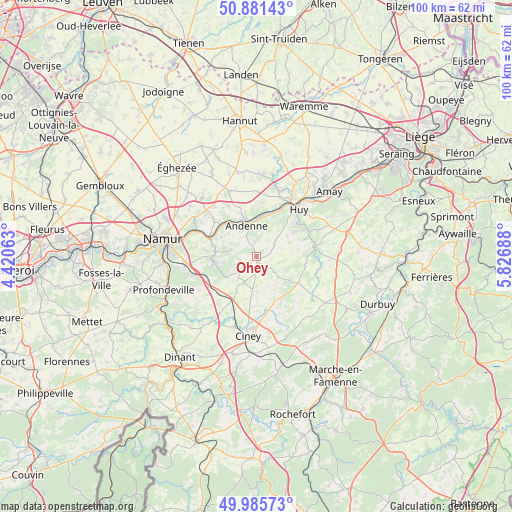
Ohey GPS coordinates[2]
50° 26' 8.52" North, 5° 7' 25.5" East
| Map corner | latitude | longitude |
|---|---|---|
| Upper-left | 50.88143°, | 4.42063° |
| Center: | 50.4357°, | 5.12375° |
| Lower-right: | 49.98573°, | 5.82688° |
| Map W x H: | 99.6×99.6 km | = 61.9×61.9mi |
| max Lat: | 51.46791° ⇑80.7% North |
| Ohey: | 50.4357° |
| min Lat: | ⇓19.3% South 49.53771° |
| min Long | Ohey | max Long |
| 2.59368° | 5.12375° | 6.25749° |
| W 71.3%⇐ | ⇒28.7% E |
Elevation
Elevation of Ohey is 269 m = 883 ft, and this is 169.5 m = 556 ft above average elevation for this country.
| Max E: |
582 m = 1909 ft | 9.4% |
| Ohey | 269 m 883 ft | |
| Avg. | 99.5 m = 326 ft | |
Min E: |
1 m = 3 ft | 90.6% |
See also: Belgium elevation on elevation.city.
Geographical zone
Ohey is located in North temperate zone (between Tropic of Cancer and the Arctic Circle). Distance of this North polar circle is 1793.2 km =1114.2 mi to North.| Distance of | km | miles | from Ohey |
|---|---|---|---|
| North Pole | 4399.1 | 2733.5 | to North |
| Arctic Circle | 1793.2 | 1114.2 | to North |
| Tropic Cancer | 3002 | 1865.4 | to South |
| Equator | 5607.9 | 3484.6 | to South |


Nearby cities:
15 places around Ohey: (largest is in red/bold)
• Andenne
6.3 km =3.9 mi,  341°
341°
• Assesse
10.3 km =6.4 mi,  224°
224°
• Ciney
15.8 km =9.8 mi,  186°
186°
• Clavier
16.6 km =10.3 mi,  103°
103°
• Gesves
5.2 km =3.2 mi, 222°
• Hamois
10.9 km =6.8 mi,  167°
167°
• Havelange
9.6 km =6 mi,  122°
122°
• Hingeon
13 km =8.1 mi,  320°
320°
• Huy
12.1 km =7.5 mi,  39°
39°
• Héron
12.5 km =7.8 mi,  351°
351°
• Marchin
9.1 km =5.7 mi,  67°
67°
• Marchovelette
16.2 km =10.1 mi,  306°
306°
• Modave
12.2 km =7.6 mi,  84°
84°
• Pontillas
14.6 km =9.1 mi,  330°
330°
• Wanze
13 km =8.1 mi,  27°
27°
Sources, notices
• [Note1] Compared only with cities in Belgium existing in our database
• [Src1] Map data: © OpenStreetMap contributors (CC-BY-SA)
• [Src2] Other city data from geonames.org with taken over terms of usage.
• [Src3] Geographical zone / Annual Mean Temperature by Robert A. Rohde @ Wikipedia
