Maaseik geodata
Maaseik (Flanders) is a populated place; located in Belgium in Europe/Brussels (GMT+2) time zone. With population of 23,684 people, there are 87 cities with bigger population in this country. Compared to other cities in Belgium, 80.5% of cities are located further ↓South; 93.9% of cities are located further ←West and 62.3% of cities have higher elevation than Maaseik. Note1
Administrative division(s):
- Level 1: Flanders
- Level 2: Provincie Limburg
- Level 3: Arrondissement Maaseik
- Level 4: Maaseik


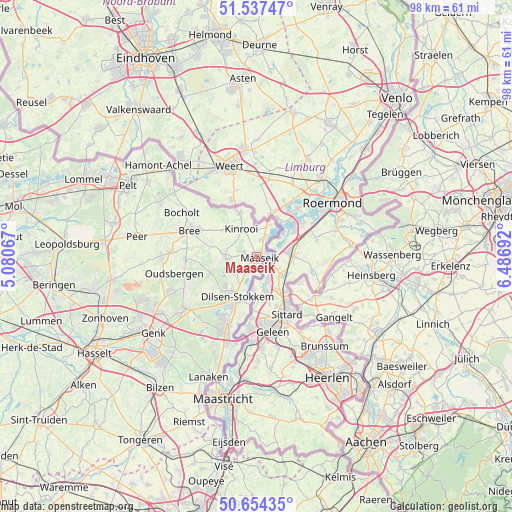
Maaseik GPS coordinates[2]
51° 5' 52.872" North, 5° 47' 1.644" East
| Map corner | latitude | longitude |
|---|---|---|
| Upper-left | 51.53747°, | 5.08067° |
| Center: | 51.09802°, | 5.78379° |
| Lower-right: | 50.65435°, | 6.48692° |
| Map W x H: | 98.2×98.2 km | = 61×61mi |
| max Lat: | 51.46791° ⇑19.5% North |
| Maaseik: | 51.09802° |
| min Lat: | ⇓80.5% South 49.53771° |
| min Long | Maaseik | max Long |
| 2.59368° | 5.78379° | 6.25749° |
| W 93.9%⇐ | ⇒6.1% E |
Elevation
Elevation of Maaseik is 30 m = 98 ft, and this is 69.5 m = 228 ft below average elevation for this country.
| Max E: |
582 m = 1909 ft | 62.3% |
| Avg. | 99.5 m = 326 ft | |
| Maaseik | 30 m = 98 ft | |
Min E: |
1 m = 3 ft | 37.7% |
See also: Belgium elevation on elevation.city.
Geographical zone
Maaseik is located in North temperate zone (between Tropic of Cancer and the Arctic Circle). Distance of this North polar circle is 1719.6 km =1068.5 mi to North.| Distance of | km | miles | from Maaseik |
|---|---|---|---|
| North Pole | 4325.5 | 2687.7 | to North |
| Arctic Circle | 1719.6 | 1068.5 | to North |
| Tropic Cancer | 3075.6 | 1911.1 | to South |
| Equator | 5681.6 | 3530.4 | to South |


Nearby cities:
15 places around Maaseik: (largest is in red/bold)
• As
17.2 km =10.7 mi,  234°
234°
• Bilzen
31.1 km =19.3 mi,  216°
216°
• Bocholt
16.5 km =10.3 mi,  300°
300°
• Bree
13.9 km =8.6 mi,  290°
290°
• Genk
24.7 km =15.3 mi, 233°
• Helchteren
28.4 km =17.6 mi,  260°
260°
• Houthalen
29.5 km =18.3 mi, 256°
• Kinrooi
6 km =3.7 mi,  331°
331°
• Lanaken
24.7 km =15.3 mi,  202°
202°
• Maasmechelen
16 km =9.9 mi, 202°
• Neerpelt
27.8 km =17.3 mi, 301°
• Opglabbeek
15.3 km =9.5 mi,  246°
246°
• Overpelt
28.6 km =17.8 mi, 295°
• Peer
22.9 km =14.2 mi,  279°
279°
• Zutendaal
23.4 km =14.5 mi, 218°
Sources, notices
• [Note1] Compared only with cities in Belgium existing in our database
• [Src1] Map data: © OpenStreetMap contributors (CC-BY-SA)
• [Src2] Other city data from geonames.org with taken over terms of usage.
• [Src3] Geographical zone / Annual Mean Temperature by Robert A. Rohde @ Wikipedia
