Houthalen geodata
Houthalen (Flanders) is a populated place; located in Belgium in Europe/Brussels (GMT+2) time zone. With population of 30,050 people, there are 58 cities with bigger population in this country. Compared to other cities in Belgium, 74.4% of cities are located further ↓South; 80.1% of cities are located further ←West and 55.8% of cities have lower elevation than Houthalen. Note1
Administrative division(s):
- Level 1: Flanders
- Level 2: Provincie Limburg
- Level 3: Arrondissement Maaseik
- Level 4: Houthalen-Helchteren


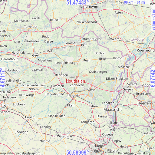
Houthalen GPS coordinates[2]
51° 2' 3.372" North, 5° 22' 27.444" East
| Map corner | latitude | longitude |
|---|---|---|
| Upper-left | 51.47433°, | 4.67117° |
| Center: | 51.03427°, | 5.37429° |
| Lower-right: | 50.58999°, | 6.07742° |
| Map W x H: | 98.3×98.3 km | = 61.1×61.1mi |
| max Lat: | 51.46791° ⇑25.6% North |
| Houthalen: | 51.03427° |
| min Lat: | ⇓74.4% South 49.53771° |
| min Long | Houthalen | max Long |
| 2.59368° | 5.37429° | 6.25749° |
| W 80.1%⇐ | ⇒19.9% E |
Elevation
Elevation of Houthalen is 64 m = 210 ft, and this is 35.5 m = 116 ft below average elevation for this country.
| Max E: |
582 m = 1909 ft | 44.2% |
| Avg. | 99.5 m = 326 ft | |
| Houthalen | 64 m = 210 ft | |
Min E: |
1 m = 3 ft | 55.8% |
See also: Belgium elevation on elevation.city.
Geographical zone
Houthalen is located in North temperate zone (between Tropic of Cancer and the Arctic Circle). Distance of this North polar circle is 1726.7 km =1072.9 mi to North.| Distance of | km | miles | from Houthalen |
|---|---|---|---|
| North Pole | 4332.6 | 2692.2 | to North |
| Arctic Circle | 1726.7 | 1072.9 | to North |
| Tropic Cancer | 3068.6 | 1906.7 | to South |
| Equator | 5674.5 | 3526 | to South |


Nearby cities:
15 places around Houthalen: (largest is in red/bold)
• As
15 km =9.3 mi,  101°
101°
• Beringen
10.5 km =6.5 mi,  279°
279°
• Diepenbeek
14.4 km =8.9 mi,  167°
167°
• Genk
11.7 km =7.3 mi,  131°
131°
• Hasselt
11.8 km =7.3 mi,  192°
192°
• Helchteren
2.5 km =1.6 mi,  13°
13°
• Herk-de-Stad
17.9 km =11.1 mi,  234°
234°
• Heusden
6.6 km =4.1 mi,  272°
272°
• Leopoldsburg
12.6 km =7.8 mi,  316°
316°
• Lummen
13.8 km =8.6 mi,  247°
247°
• Opglabbeek
14.7 km =9.1 mi,  86°
86°
• Peer
12.2 km =7.6 mi,  29°
29°
• Terkoest
16.6 km =10.3 mi,  204°
204°
• Zonhoven
4.9 km =3 mi, 185°
• Zutendaal
18 km =11.2 mi, 128°
Sources, notices
• [Note1] Compared only with cities in Belgium existing in our database
• [Src1] Map data: © OpenStreetMap contributors (CC-BY-SA)
• [Src2] Other city data from geonames.org with taken over terms of usage.
• [Src3] Geographical zone / Annual Mean Temperature by Robert A. Rohde @ Wikipedia
