Helchteren geodata
Helchteren (Flanders) is a populated place; located in Belgium in Europe/Brussels (GMT+2) time zone. With population of 30,050 people, there are 58 cities with bigger population in this country. Compared to other cities in Belgium, 76.2% of cities are located further ↓South; 80.5% of cities are located further ←West and 57.8% of cities have lower elevation than Helchteren. Note1
Administrative division(s):
- Level 1: Flanders
- Level 2: Provincie Limburg
- Level 3: Arrondissement Maaseik
- Level 4: Houthalen-Helchteren


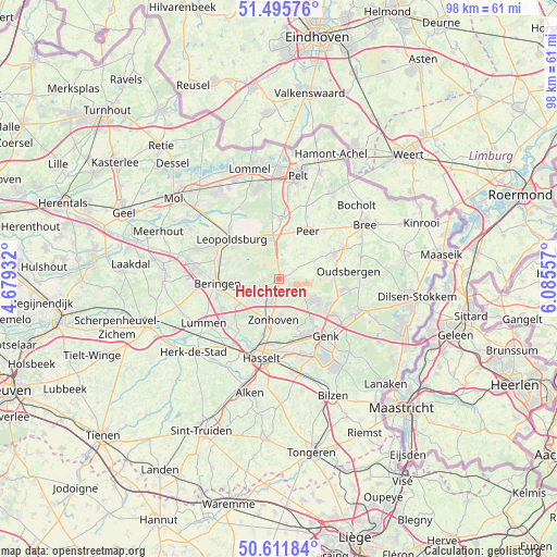
Helchteren GPS coordinates[2]
51° 3' 21.276" North, 5° 22' 56.784" East
| Map corner | latitude | longitude |
|---|---|---|
| Upper-left | 51.49576°, | 4.67932° |
| Center: | 51.05591°, | 5.38244° |
| Lower-right: | 50.61184°, | 6.08557° |
| Map W x H: | 98.3×98.3 km | = 61.1×61.1mi |
| max Lat: | 51.46791° ⇑23.8% North |
| Helchteren: | 51.05591° |
| min Lat: | ⇓76.2% South 49.53771° |
| min Long | Helchteren | max Long |
| 2.59368° | 5.38244° | 6.25749° |
| W 80.5%⇐ | ⇒19.5% E |
Elevation
Elevation of Helchteren is 72 m = 236 ft, and this is 27.5 m = 90 ft below average elevation for this country.
| Max E: |
582 m = 1909 ft | 42.2% |
| Avg. | 99.5 m = 326 ft | |
| Helchteren | 72 m = 236 ft | |
Min E: |
1 m = 3 ft | 57.8% |
See also: Belgium elevation on elevation.city.
Geographical zone
Helchteren is located in North temperate zone (between Tropic of Cancer and the Arctic Circle). Distance of this North polar circle is 1724.3 km =1071.4 mi to North.| Distance of | km | miles | from Helchteren |
|---|---|---|---|
| North Pole | 4330.2 | 2690.7 | to North |
| Arctic Circle | 1724.3 | 1071.4 | to North |
| Tropic Cancer | 3071 | 1908.2 | to South |
| Equator | 5676.9 | 3527.5 | to South |


Nearby cities:
15 places around Helchteren: (largest is in red/bold)
• As
15.1 km =9.4 mi,  110°
110°
• Beringen
11 km =6.8 mi,  266°
266°
• Bocholt
19 km =11.8 mi,  46°
46°
• Bree
17.7 km =11 mi,  57°
57°
• Diepenbeek
16.7 km =10.4 mi,  171°
171°
• Genk
13.1 km =8.1 mi,  140°
140°
• Hasselt
14.2 km =8.8 mi,  192°
192°
• Heusden
7.5 km =4.7 mi,  253°
253°
• Houthalen
2.5 km =1.6 mi, 193°
• Leopoldsburg
11.5 km =7.1 mi,  306°
306°
• Lummen
15.4 km =9.6 mi,  240°
240°
• Opglabbeek
14.1 km =8.8 mi,  96°
96°
• Overpelt
17.3 km =10.7 mi,  7°
7°
• Peer
9.9 km =6.2 mi,  33°
33°
• Zonhoven
7.3 km =4.5 mi, 187°
Sources, notices
• [Note1] Compared only with cities in Belgium existing in our database
• [Src1] Map data: © OpenStreetMap contributors (CC-BY-SA)
• [Src2] Other city data from geonames.org with taken over terms of usage.
• [Src3] Geographical zone / Annual Mean Temperature by Robert A. Rohde @ Wikipedia
