Overpelt geodata
Overpelt (Flanders) is a populated place; located in Belgium in Europe/Brussels (GMT+2) time zone. With population of 13,344 people, there are 223 cities with bigger population in this country. Compared to other cities in Belgium, 91.3% of cities are located further ↓South; 81.4% of cities are located further ←West and 53.4% of cities have higher elevation than Overpelt. Note1
Administrative division(s):
- Level 1: Flanders
- Level 2: Provincie Limburg
- Level 3: Arrondissement Maaseik
- Level 4: Pelt


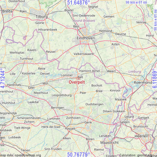
Overpelt GPS coordinates[2]
51° 12' 37.368" North, 5° 24' 56.052" East
| Map corner | latitude | longitude |
|---|---|---|
| Upper-left | 51.64876°, | 4.71244° |
| Center: | 51.21038°, | 5.41557° |
| Lower-right: | 50.76779°, | 6.11869° |
| Map W x H: | 98×98 km | = 60.9×60.9mi |
| max Lat: | 51.46791° ⇑8.7% North |
| Overpelt: | 51.21038° |
| min Lat: | ⇓91.3% South 49.53771° |
| min Long | Overpelt | max Long |
| 2.59368° | 5.41557° | 6.25749° |
| W 81.4%⇐ | ⇒18.6% E |
Elevation
Elevation of Overpelt is 44 m = 144 ft, and this is 55.5 m = 182 ft below average elevation for this country.
| Max E: |
582 m = 1909 ft | 53.4% |
| Avg. | 99.5 m = 326 ft | |
| Overpelt | 44 m = 144 ft | |
Min E: |
1 m = 3 ft | 46.6% |
See also: Belgium elevation on elevation.city.
Geographical zone
Overpelt is located in North temperate zone (between Tropic of Cancer and the Arctic Circle). Distance of this North polar circle is 1707.1 km =1060.7 mi to North.| Distance of | km | miles | from Overpelt |
|---|---|---|---|
| North Pole | 4313 | 2680 | to North |
| Arctic Circle | 1707.1 | 1060.7 | to North |
| Tropic Cancer | 3088.1 | 1918.9 | to South |
| Equator | 5694.1 | 3538.1 | to South |


Nearby cities:
15 places around Overpelt: (largest is in red/bold)
• Balen
17.7 km =11 mi,  254°
254°
• Beringen
22.2 km =13.8 mi,  216°
216°
• Bocholt
12.2 km =7.6 mi,  109°
109°
• Bree
14.8 km =9.2 mi,  121°
121°
• Dessel
21.2 km =13.2 mi,  278°
278°
• Helchteren
17.3 km =10.7 mi,  187°
187°
• Heusden
21.5 km =13.4 mi,  206°
206°
• Houthalen
19.8 km =12.3 mi, 188°
• Kinrooi
23.9 km =14.9 mi, 107°
• Leopoldsburg
15.6 km =9.7 mi,  227°
227°
• Lommel
7.5 km =4.7 mi,  287°
287°
• Mol
20.9 km =13 mi,  264°
264°
• Neerpelt
2.7 km =1.7 mi,  43°
43°
• Opglabbeek
22 km =13.7 mi,  147°
147°
• Peer
9.4 km =5.8 mi,  161°
161°
Sources, notices
• [Note1] Compared only with cities in Belgium existing in our database
• [Src1] Map data: © OpenStreetMap contributors (CC-BY-SA)
• [Src2] Other city data from geonames.org with taken over terms of usage.
• [Src3] Geographical zone / Annual Mean Temperature by Robert A. Rohde @ Wikipedia
