Niou geodata
Niou (Plateau-Central) is a seat of a third-order administrative division; located in Burkina Faso in Africa/Ouagadougou (GMT+0) time zone. In our database, there are 49 cities with bigger population. Compared to other cities in Burkina Faso, 70.9% of cities are located further ↓South; 69.6% of cities are located further →East and 67.1% of cities have lower elevation than Niou. Note1


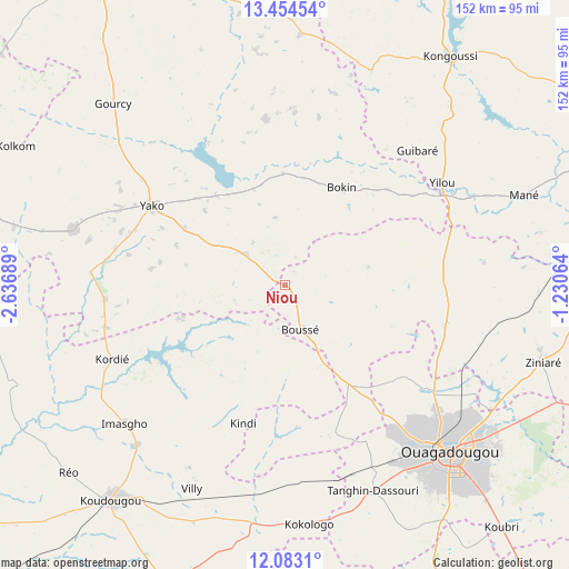
Niou GPS coordinates[2]
12° 46' 11.1" North, 1° 56' 1.536" West
| Map corner | latitude | longitude |
|---|---|---|
| Upper-left | 13.45454°, | -2.63689° |
| Center: | 12.76975°, | -1.93376° |
| Lower-right: | 12.0831°, | -1.23064° |
| Map W x H: | 152.5×152.5 km | = 94.8×94.8mi |
| max Lat: | 14.96549° ⇑29.1% North |
| Niou: | 12.76975° |
| min Lat: | ⇓70.9% South 9.88333° |
| min Long | Niou | max Long |
| -5.16667° | -1.93376° | 1.78838° |
| W 30.4%⇐ | ⇒69.6% E |
Elevation
Elevation of Niou is 315 m = 1033 ft, and this is 12 m = 39 ft above average elevation for this country.
| Max E: |
423 m = 1388 ft | 32.9% |
| Niou | 315 m 1033 ft | |
| Avg. | 303 m = 994 ft | |
Min E: |
222 m = 728 ft | 67.1% |
See also: Burkina Faso elevation on elevation.city.
Geographical zone
Niou is located in North Torrid zone (between Equator and Tropic of Cancer). Distance of this Northern Tropic circle is 1186.1 km =737 mi to North.| Distance of | km | miles | from Niou |
|---|---|---|---|
| North Pole | 8587.2 | 5335.8 | to North |
| Arctic Circle | 5981.3 | 3716.6 | to North |
| Tropic Cancer | 1186.1 | 737 | to North |
| Equator | 1419.9 | 882.3 | to South |


Nearby cities:
15 places around Niou: (largest is in red/bold)
• Bingo
53.2 km =33.1 mi,  168°
168°
• Boussé
12.8 km =8 mi,  160°
160°
• Dapélogo
44.1 km =27.4 mi,  104°
104°
• Goulouré
59.5 km =37 mi,  180°
180°
• Kokologo
64.3 km =40 mi, 174°
• Laye
31.5 km =19.6 mi,  147°
147°
• Ouagadougou
62.5 km =38.8 mi,  135°
135°
• Ourgou-Manéga
46.2 km =28.7 mi,  88°
88°
• Pabré
46.7 km =29 mi,  126°
126°
• Pitmoaga
58.6 km =36.4 mi, 174°
• Siglé
24.3 km =15.1 mi, 168°
• Sourgoubila
41.8 km =26 mi, 160°
• Tanghin-Dassouri
60.1 km =37.3 mi, 156°
• Toéghin
22.9 km =14.2 mi,  77°
77°
• Yako
41.2 km =25.6 mi,  300°
300°
Sources, notices
• [Note1] Compared only with cities in Burkina Faso existing in our database
• [Src1] Map data: © OpenStreetMap contributors (CC-BY-SA)
• [Src2] Other city data from geonames.org with taken over terms of usage.
• [Src3] Geographical zone / Annual Mean Temperature by Robert A. Rohde @ Wikipedia
