Ourgou-Manéga geodata
Ourgou-Manéga (Plateau-Central) is a seat of a third-order administrative division; located in Burkina Faso in Africa/Ouagadougou (GMT+0) time zone. In our database, there are 49 cities with bigger population. Compared to other cities in Burkina Faso, 72.2% of cities are located further ↓South; 55.7% of cities are located further ←West and 62% of cities have lower elevation than Ourgou-Manéga. Note1


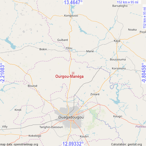
Ourgou-Manéga GPS coordinates[2]
12° 46' 47.784" North, 1° 30' 27.72" West
| Map corner | latitude | longitude |
|---|---|---|
| Upper-left | 13.4647°, | -2.21083° |
| Center: | 12.77994°, | -1.5077° |
| Lower-right: | 12.09332°, | -0.80458° |
| Map W x H: | 152.5×152.5 km | = 94.8×94.8mi |
| max Lat: | 14.96549° ⇑27.8% North |
| Ourgou-Manéga: | 12.77994° |
| min Lat: | ⇓72.2% South 9.88333° |
| min Long | Ourgou-Manéga | max Long |
| -5.16667° | -1.5077° | 1.78838° |
| W 55.7%⇐ | ⇒44.3% E |
Elevation
Elevation of Ourgou-Manéga is 307 m = 1007 ft, and this is 4 m = 13 ft above average elevation for this country.
| Max E: |
423 m = 1388 ft | 38% |
| Ourgou-Manéga | 307 m 1007 ft | |
| Avg. | 303 m = 994 ft | |
Min E: |
222 m = 728 ft | 62% |
See also: Burkina Faso elevation on elevation.city.
Geographical zone
Ourgou-Manéga is located in North Torrid zone (between Equator and Tropic of Cancer). Distance of this Northern Tropic circle is 1184.9 km =736.3 mi to North.| Distance of | km | miles | from Ourgou-Manéga |
|---|---|---|---|
| North Pole | 8586.1 | 5335.2 | to North |
| Arctic Circle | 5980.2 | 3715.9 | to North |
| Tropic Cancer | 1184.9 | 736.3 | to North |
| Equator | 1421 | 883 | to South |


Nearby cities:
15 places around Ourgou-Manéga: (largest is in red/bold)
• Boussé
44 km =27.3 mi,  252°
252°
• Dapélogo
12.4 km =7.7 mi,  195°
195°
• Korsimoro
48 km =29.8 mi,  84°
84°
• Laye
40.2 km =25 mi,  226°
226°
• Loumbila
32.5 km =20.2 mi,  153°
153°
• Mané
29.2 km =18.1 mi,  37°
37°
• Nagréongo
47.2 km =29.3 mi,  135°
135°
• Niou
46.2 km =28.7 mi,  268°
268°
• Ouagadougou
46.2 km =28.7 mi,  183°
183°
• Pabré
30 km =18.6 mi, 196°
• Saaba
46.5 km =28.9 mi,  167°
167°
• Siglé
48.2 km =30 mi,  238°
238°
• Toéghin
24.2 km =15 mi,  279°
279°
• Ziniaré
31.7 km =19.7 mi,  133°
133°
• Zitenga
21.7 km =13.5 mi,  99°
99°
Sources, notices
• [Note1] Compared only with cities in Burkina Faso existing in our database
• [Src1] Map data: © OpenStreetMap contributors (CC-BY-SA)
• [Src2] Other city data from geonames.org with taken over terms of usage.
• [Src3] Geographical zone / Annual Mean Temperature by Robert A. Rohde @ Wikipedia
