Yako geodata
Yako (Nord) is a seat of a second-order administrative division; located in Burkina Faso in Africa/Ouagadougou (GMT+0) time zone. With population of 22,904 people, there are 21 cities with bigger population in this country. Compared to other cities in Burkina Faso, 77.2% of cities are located further ↓South; 74.7% of cities are located further →East and 87.3% of cities have lower elevation than Yako. Note1


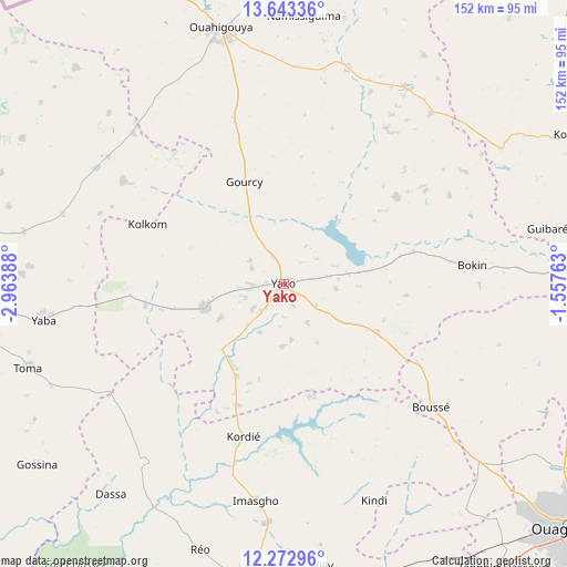
Yako GPS coordinates[2]
12° 57' 32.76" North, 2° 15' 38.7" West
| Map corner | latitude | longitude |
|---|---|---|
| Upper-left | 13.64336°, | -2.96388° |
| Center: | 12.9591°, | -2.26075° |
| Lower-right: | 12.27296°, | -1.55763° |
| Map W x H: | 152.4×152.4 km | = 94.7×94.7mi |
| max Lat: | 14.96549° ⇑22.8% North |
| Yako: | 12.9591° |
| min Lat: | ⇓77.2% South 9.88333° |
| min Long | Yako | max Long |
| -5.16667° | -2.26075° | 1.78838° |
| W 25.3%⇐ | ⇒74.7% E |
Elevation
Elevation of Yako is 332 m = 1089 ft, and this is 29 m = 95 ft above average elevation for this country.
| Max E: |
423 m = 1388 ft | 12.7% |
| Yako | 332 m 1089 ft | |
| Avg. | 303 m = 994 ft | |
Min E: |
222 m = 728 ft | 87.3% |
See also: Burkina Faso elevation on elevation.city.
Geographical zone
Yako is located in North Torrid zone (between Equator and Tropic of Cancer). Distance of this Northern Tropic circle is 1165 km =723.9 mi to North.| Distance of | km | miles | from Yako |
|---|---|---|---|
| North Pole | 8566.1 | 5322.7 | to North |
| Arctic Circle | 5960.3 | 3703.6 | to North |
| Tropic Cancer | 1165 | 723.9 | to North |
| Equator | 1440.9 | 895.3 | to South |


Nearby cities:
15 places around Yako: (largest is in red/bold)
• Boussé
51.7 km =32.1 mi,  129°
129°
• Dapélogo
84.5 km =52.5 mi,  112°
112°
• Gourcy
29.6 km =18.4 mi,  338°
338°
• Gousi
67 km =41.6 mi,  239°
239°
• Koudougou
79.3 km =49.3 mi,  188°
188°
• Laye
70.8 km =44 mi, 132°
• Niou
41.2 km =25.6 mi,  120°
120°
• Ouahigouya
71.5 km =44.4 mi,  345°
345°
• Ourgou-Manéga
84 km =52.2 mi,  103°
103°
• Réo
74.7 km =46.4 mi,  197°
197°
• Siglé
60.4 km =37.5 mi,  137°
137°
• Sièn
75.2 km =46.7 mi,  246°
246°
• Sourgoubila
78.1 km =48.5 mi, 140°
• Toma
72.7 km =45.2 mi, 252°
• Toéghin
59.9 km =37.2 mi, 105°
Sources, notices
• [Note1] Compared only with cities in Burkina Faso existing in our database
• [Src1] Map data: © OpenStreetMap contributors (CC-BY-SA)
• [Src2] Other city data from geonames.org with taken over terms of usage.
• [Src3] Geographical zone / Annual Mean Temperature by Robert A. Rohde @ Wikipedia
