Goulouré geodata
Goulouré (Centre-Ouest) is a populated place; located in Burkina Faso in Africa/Ouagadougou (GMT+0) time zone. With population of 6,677 people, there are 41 cities with bigger population in this country. Compared to other cities in Burkina Faso, 64.6% of cities are located further ↑North; 70.9% of cities are located further →East and 75.9% of cities have lower elevation than Goulouré. Note1


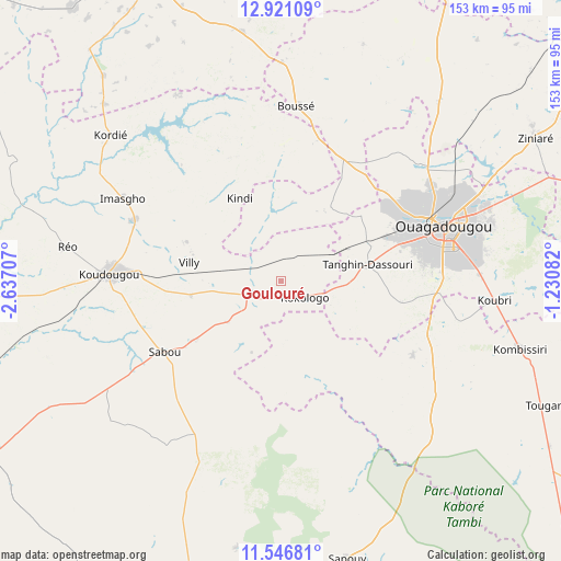
Goulouré GPS coordinates[2]
12° 14' 5.424" North, 1° 56' 2.184" West
| Map corner | latitude | longitude |
|---|---|---|
| Upper-left | 12.92109°, | -2.63707° |
| Center: | 12.23484°, | -1.93394° |
| Lower-right: | 11.54681°, | -1.23082° |
| Map W x H: | 152.8×152.8 km | = 94.9×94.9mi |
| max Lat: | 14.96549° ⇑64.6% North |
| Goulouré: | 12.23484° |
| min Lat: | ⇓35.4% South 9.88333° |
| min Long | Goulouré | max Long |
| -5.16667° | -1.93394° | 1.78838° |
| W 29.1%⇐ | ⇒70.9% E |
Elevation
Elevation of Goulouré is 325 m = 1066 ft, and this is 22 m = 72 ft above average elevation for this country.
| Max E: |
423 m = 1388 ft | 24.1% |
| Goulouré | 325 m 1066 ft | |
| Avg. | 303 m = 994 ft | |
Min E: |
222 m = 728 ft | 75.9% |
See also: Burkina Faso elevation on elevation.city.
Geographical zone
Goulouré is located in North Torrid zone (between Equator and Tropic of Cancer). Distance of this Northern Tropic circle is 1245.5 km =773.9 mi to North.| Distance of | km | miles | from Goulouré |
|---|---|---|---|
| North Pole | 8646.7 | 5372.8 | to North |
| Arctic Circle | 6040.8 | 3753.6 | to North |
| Tropic Cancer | 1245.5 | 773.9 | to North |
| Equator | 1360.4 | 845.3 | to South |


Nearby cities:
15 places around Goulouré: (largest is in red/bold)
• Bingo
13 km =8.1 mi,  55°
55°
• Boussé
47.6 km =29.6 mi,  5°
5°
• Kayao
26.6 km =16.5 mi,  157°
157°
• Kokologo
7.7 km =4.8 mi,  126°
126°
• Komki-Ipala
16.5 km =10.3 mi,  110°
110°
• Komsilga
33.1 km =20.6 mi,  99°
99°
• Koudougou
46.6 km =29 mi,  272°
272°
• Laye
37.1 km =23.1 mi,  27°
27°
• Ouagadougou
45.8 km =28.5 mi,  71°
71°
• Pabré
49.4 km =30.7 mi,  49°
49°
• Pitmoaga
5.8 km =3.6 mi,  78°
78°
• Saponé
41.1 km =25.5 mi,  119°
119°
• Siglé
36.1 km =22.4 mi, 7°
• Sourgoubila
24.3 km =15.1 mi, 34°
• Tanghin-Dassouri
23.9 km =14.9 mi, 79°
Sources, notices
• [Note1] Compared only with cities in Burkina Faso existing in our database
• [Src1] Map data: © OpenStreetMap contributors (CC-BY-SA)
• [Src2] Other city data from geonames.org with taken over terms of usage.
• [Src3] Geographical zone / Annual Mean Temperature by Robert A. Rohde @ Wikipedia
