Kaynardzha geodata
Kaynardzha (Silistra) is a seat of a second-order administrative division; located in Bulgaria in Europe/Sofia (GMT+3) time zone. With population of 1,107 people, there are 268 cities with bigger population in this country. Compared to other cities in Bulgaria, 98.3% of cities are located further ↓South; 88.3% of cities are located further ←West and 79.3% of cities have higher elevation than Kaynardzha. Note1


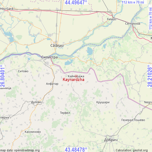
Kaynardzha GPS coordinates[2]
43° 59' 34.008" North, 27° 30' 25.668" East
| Map corner | latitude | longitude |
|---|---|---|
| Upper-left | 44.49647°, | 26.80401° |
| Center: | 43.99278°, | 27.50713° |
| Lower-right: | 43.48478°, | 28.21026° |
| Map W x H: | 112.5×112.5 km | = 69.9×69.9mi |
| max Lat: | 44.16214° ⇑1.7% North |
| Kaynardzha: | 43.99278° |
| min Lat: | ⇓98.3% South 41.32715° |
| min Long | Kaynardzha | max Long |
| 22.52139° | 27.50713° | 28.53429° |
| W 88.3%⇐ | ⇒11.7% E |
Elevation
Elevation of Kaynardzha is 102 m = 335 ft, and this is 214.6 m = 704 ft below average elevation for this country.
| Max E: |
1221 m = 4006 ft | 79.3% |
| Avg. | 316.6 m = 1039 ft | |
| Kaynardzha | 102 m = 335 ft | |
Min E: |
1 m = 3 ft | 20.7% |
See also: Bulgaria elevation on elevation.city.
Geographical zone
Kaynardzha is located in North temperate zone (between Tropic of Cancer and the Arctic Circle). Distance of this Northern Tropic circle is 2285.6 km =1420.2 mi to South.| Distance of | km | miles | from Kaynardzha |
|---|---|---|---|
| North Pole | 5115.5 | 3178.6 | to North |
| Arctic Circle | 2509.6 | 1559.4 | to North |
| Tropic Cancer | 2285.6 | 1420.2 | to South |
| Equator | 4891.5 | 3039.4 | to South |


Nearby cities:
15 places around Kaynardzha: (largest is in red/bold)
• Alfatar
18.4 km =11.4 mi,  253°
253°
• Dobrich
54.1 km =33.6 mi,  151°
151°
• Dulovo
34.7 km =21.6 mi,  235°
235°
• General Toshevo
53.5 km =33.2 mi,  127°
127°
• Glavinitsa
54.6 km =33.9 mi,  261°
261°
• Isperih
62.1 km =38.6 mi, 240°
• Kaolinovo
52.3 km =32.5 mi,  216°
216°
• Krushari
27.9 km =17.3 mi, 134°
• Nikola-Kozlevo
52.2 km =32.4 mi,  204°
204°
• Silistra
24.1 km =15 mi,  305°
305°
• Sitovo
39.2 km =24.4 mi,  275°
275°
• Tervel
28.3 km =17.6 mi, 196°
• Valchidol
66 km =41 mi,  177°
177°
• Venets
67.4 km =41.9 mi, 223°
• Zavet
71.1 km =44.2 mi, 248°
Sources, notices
• [Note1] Compared only with cities in Bulgaria existing in our database
• [Src1] Map data: © OpenStreetMap contributors (CC-BY-SA)
• [Src2] Other city data from geonames.org with taken over terms of usage.
• [Src3] Geographical zone / Annual Mean Temperature by Robert A. Rohde @ Wikipedia
