Kaloyanovo geodata
Kaloyanovo (Plovdiv) is a populated place; located in Bulgaria in Europe/Sofia (GMT+3) time zone. With population of 2,782 people, there are 207 cities with bigger population in this country. Compared to other cities in Bulgaria, 70.7% of cities are located further ↑North; 56.7% of cities are located further →East and 51% of cities have higher elevation than Kaloyanovo. Note1


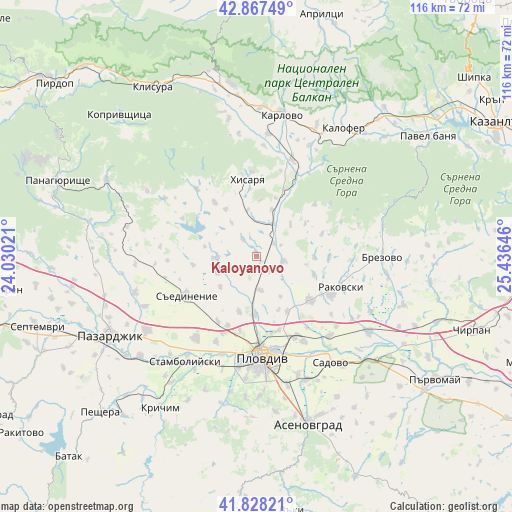
Kaloyanovo GPS coordinates[2]
42° 21' 0" North, 24° 43' 59.988" East
| Map corner | latitude | longitude |
|---|---|---|
| Upper-left | 42.86749°, | 24.03021° |
| Center: | 42.35°, | 24.73333° |
| Lower-right: | 41.82821°, | 25.43646° |
| Map W x H: | 115.6×115.6 km | = 71.8×71.8mi |
| max Lat: | 44.16214° ⇑70.7% North |
| Kaloyanovo: | 42.35° |
| min Lat: | ⇓29.3% South 41.32715° |
| min Long | Kaloyanovo | max Long |
| 22.52139° | 24.73333° | 28.53429° |
| W 43.3%⇐ | ⇒56.7% E |
Elevation
Elevation of Kaloyanovo is 219 m = 719 ft, and this is 97.6 m = 320 ft below average elevation for this country.
| Max E: |
1221 m = 4006 ft | 51% |
| Avg. | 316.6 m = 1039 ft | |
| Kaloyanovo | 219 m = 719 ft | |
Min E: |
1 m = 3 ft | 49% |
See also: Bulgaria elevation on elevation.city.
Geographical zone
Kaloyanovo is located in North temperate zone (between Tropic of Cancer and the Arctic Circle). Distance of this Northern Tropic circle is 2103 km =1306.7 mi to South.| Distance of | km | miles | from Kaloyanovo |
|---|---|---|---|
| North Pole | 5298.2 | 3292.1 | to North |
| Arctic Circle | 2692.3 | 1672.9 | to North |
| Tropic Cancer | 2103 | 1306.7 | to South |
| Equator | 4708.9 | 2926 | to South |


Nearby cities:
15 places around Kaloyanovo: (largest is in red/bold)
• Asenovgrad
38.7 km =24 mi,  163°
163°
• Brezovo
28.8 km =17.9 mi,  90°
90°
• Hisarya
16.9 km =10.5 mi,  350°
350°
• Kalofer
36 km =22.4 mi,  34°
34°
• Karlovo
32 km =19.9 mi,  9°
9°
• Krichim
39.9 km =24.8 mi,  213°
213°
• Pazardzhik
36.9 km =22.9 mi,  243°
243°
• Perushtitsa
36.6 km =22.7 mi,  204°
204°
• Plovdiv
22.3 km =13.9 mi,  176°
176°
• Rakovski
19 km =11.8 mi,  116°
116°
• Sadovo
29.6 km =18.4 mi,  144°
144°
• Saedinenie
17.7 km =11 mi, 238°
• Stamboliyski
29.2 km =18.1 mi, 214°
• Strelcha
38 km =23.6 mi,  295°
295°
• Zelenikovo
29.3 km =18.2 mi,  79°
79°
Sources, notices
• [Note1] Compared only with cities in Bulgaria existing in our database
• [Src1] Map data: © OpenStreetMap contributors (CC-BY-SA)
• [Src2] Other city data from geonames.org with taken over terms of usage.
• [Src3] Geographical zone / Annual Mean Temperature by Robert A. Rohde @ Wikipedia
