Totora geodata
Totora (Cochabamba) is a populated place; located in Bolivia in America/La_Paz (GMT-4) time zone. With population of 1,597 people, there are 113 cities with bigger population in this country. Compared to other cities in Bolivia, 55.9% of cities are located further ↓South; 51.6% of cities are located further ←West and 65.2% of cities have lower elevation than Totora. Note1


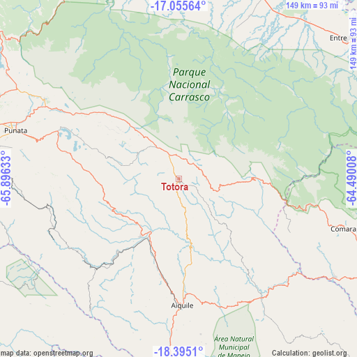
Totora GPS coordinates[2]
17° 43' 35.832" South, 65° 11' 35.52" West
| Map corner | latitude | longitude |
|---|---|---|
| Upper-left | -17.05564°, | -65.89633° |
| Center: | -17.72662°, | -65.1932° |
| Lower-right: | -18.3951°, | -64.49008° |
| Map W x H: | 148.9×148.9 km | = 92.5×92.5mi |
| max Lat: | -9.71828° ⇑44.1% North |
| Totora: | -17.72662° |
| min Lat: | ⇓55.9% South -22.73206° |
| min Long | Totora | max Long |
| -69.14843° | -65.1932° | -57.76667° |
| W 51.6%⇐ | ⇒48.4% E |
Elevation
Elevation of Totora is 2896 m = 9501 ft, and this is 884.7 m = 2903 ft above average elevation for this country.
| Max E: |
4732 m = 15525 ft | 34.8% |
| Totora | 2896 m 9501 ft | |
| Avg. | 2011.3 m = 6599 ft | |
Min E: |
92 m = 302 ft | 65.2% |
See also: Bolivia elevation on elevation.city.
Geographical zone
Totora is located in South Torrid zone (between Equator and Tropic of Capricorn). Distance of this Southern Tropic circle is 634.9 km =394.5 mi to South.| Distance of | km | miles | from Totora |
|---|---|---|---|
| Equator | 1971 | 1224.7 | to North |
| Tropic Capricorn | 634.9 | 394.5 | to South |
| Antarctic Circle | 5430.2 | 3374.2 | to South |
| South Pole | 8036 | 4993.3 | to South |


Nearby cities:
15 places around Totora: (largest is in red/bold)
• Aiquile
53.1 km =33 mi,  178°
178°
• Arani
63.5 km =39.5 mi,  286°
286°
• Capinota
113.1 km =70.3 mi,  270°
270°
• Cañada Hornillos
7.3 km =4.5 mi,  51°
51°
• Chimoré
81.6 km =50.7 mi,  2°
2°
• Cliza
79.8 km =49.6 mi,  281°
281°
• Cochabamba
108.8 km =67.6 mi, 290°
• Colomi
82.8 km =51.4 mi,  300°
300°
• Comarapa
73.1 km =45.4 mi,  106°
106°
• Irpa Irpa
113.7 km =70.6 mi, 270°
• Mizque
28.5 km =17.7 mi,  213°
213°
• Piocera
115.9 km =72 mi,  190°
190°
• Punata
71 km =44.1 mi, 286°
• Sacaba
96.7 km =60.1 mi, 292°
• Tarata
88.7 km =55.1 mi, 278°
Sources, notices
• [Note1] Compared only with cities in Bolivia existing in our database
• [Src1] Map data: © OpenStreetMap contributors (CC-BY-SA)
• [Src2] Other city data from geonames.org with taken over terms of usage.
• [Src3] Geographical zone / Annual Mean Temperature by Robert A. Rohde @ Wikipedia
