Irauçuba geodata
Irauçuba (Ceará) is a populated place; located in Brazil in America/Fortaleza (GMT-3) time zone. With population of 13,281 people, there are 1348 cities with bigger population in this country. Compared to other cities in Brazil, 92.3% of cities are located further ↓South; 76.1% of cities are located further ←West and 67.3% of cities have higher elevation than Irauçuba. Note1


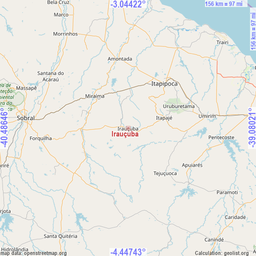
Irauçuba GPS coordinates[2]
3° 44' 45.996" South, 39° 46' 59.988" West
| Map corner | latitude | longitude |
|---|---|---|
| Upper-left | -3.04422°, | -40.48646° |
| Center: | -3.74611°, | -39.78333° |
| Lower-right: | -4.44743°, | -39.08021° |
| Map W x H: | 156×156 km | = 96.9×96.9mi |
| max Lat: | 2.81972° ⇑7.7% North |
| Irauçuba: | -3.74611° |
| min Lat: | ⇓92.3% South -33.69111° |
| min Long | Irauçuba | max Long |
| -72.89583° | -39.78333° | -32.41083° |
| W 76.1%⇐ | ⇒23.9% E |
Elevation
Elevation of Irauçuba is 150 m = 492 ft, and this is 230.9 m = 758 ft below average elevation for this country.
| Max E: |
1603 m = 5259 ft | 67.3% |
| Avg. | 380.9 m = 1250 ft | |
| Irauçuba | 150 m = 492 ft | |
Min E: |
0 m = 0 ft | 32.7% |
See also: Brazil elevation on elevation.city.
Geographical zone
Irauçuba is located in South Torrid zone (between Equator and Tropic of Capricorn). Distance of Equator is 416.5 km =258.8 mi to North.| Distance of | km | miles | from Irauçuba |
|---|---|---|---|
| Equator | 416.5 | 258.8 | to North |
| Tropic Capricorn | 2189.4 | 1360.4 | to South |
| Antarctic Circle | 6984.6 | 4340 | to South |
| South Pole | 9590.5 | 5959.3 | to South |


Nearby cities:
15 places around Irauçuba: (largest is in red/bold)
• Amontada
43.1 km =26.8 mi,  352°
352°
• Canindé
85.9 km =53.4 mi,  142°
142°
• Cariré
79.9 km =49.6 mi,  253°
253°
• Forquilha
53.3 km =33.1 mi,  263°
263°
• Itapagé
22.9 km =14.2 mi,  73°
73°
• Itapipoca
36 km =22.4 mi,  39°
39°
• Marco
80.1 km =49.8 mi,  329°
329°
• Paraipaba
78.3 km =48.7 mi,  64°
64°
• Pentecoste
57.2 km =35.5 mi,  95°
95°
• Santa Quitéria
77.2 km =48 mi,  212°
212°
• Santana do Acaraú
57.2 km =35.5 mi,  303°
303°
• Sobral
63.2 km =39.3 mi,  276°
276°
• Trairi
77.3 km =48 mi,  47°
47°
• Umirim
48.7 km =30.3 mi,  80°
80°
• Uruburetama
33.4 km =20.8 mi, 66°
Sources, notices
• [Note1] Compared only with cities in Brazil existing in our database
• [Src1] Map data: © OpenStreetMap contributors (CC-BY-SA)
• [Src2] Other city data from geonames.org with taken over terms of usage.
• [Src3] Geographical zone / Annual Mean Temperature by Robert A. Rohde @ Wikipedia
