Cedro geodata
Cedro (Ceará) is a populated place; located in Brazil in America/Fortaleza (GMT-3) time zone. With population of 14,644 people, there are 1240 cities with bigger population in this country. Compared to other cities in Brazil, 82.4% of cities are located further ↓South; 79.8% of cities are located further ←West and 56.3% of cities have higher elevation than Cedro. Note1


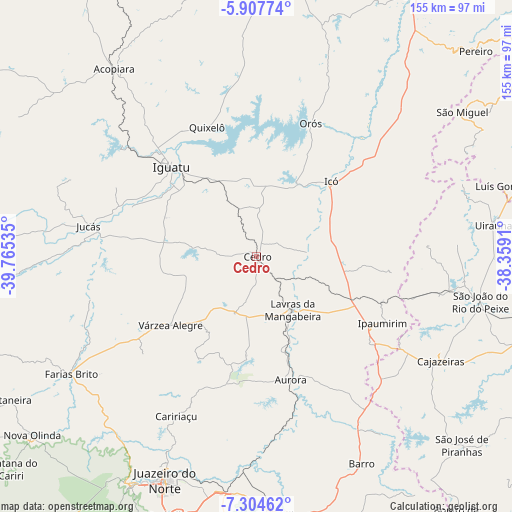
Cedro GPS coordinates[2]
6° 36' 24.012" South, 39° 3' 43.992" West
| Map corner | latitude | longitude |
|---|---|---|
| Upper-left | -5.90774°, | -39.76535° |
| Center: | -6.60667°, | -39.06222° |
| Lower-right: | -7.30462°, | -38.3591° |
| Map W x H: | 155.3×155.3 km | = 96.5×96.5mi |
| max Lat: | 2.81972° ⇑17.6% North |
| Cedro: | -6.60667° |
| min Lat: | ⇓82.4% South -33.69111° |
| min Long | Cedro | max Long |
| -72.89583° | -39.06222° | -32.41083° |
| W 79.8%⇐ | ⇒20.2% E |
Elevation
Elevation of Cedro is 252 m = 827 ft, and this is 128.9 m = 423 ft below average elevation for this country.
| Max E: |
1603 m = 5259 ft | 56.3% |
| Avg. | 380.9 m = 1250 ft | |
| Cedro | 252 m = 827 ft | |
Min E: |
0 m = 0 ft | 43.7% |
See also: Brazil elevation on elevation.city.
Geographical zone
Cedro is located in South Torrid zone (between Equator and Tropic of Capricorn). Distance of Equator is 734.6 km =456.5 mi to North.| Distance of | km | miles | from Cedro |
|---|---|---|---|
| Equator | 734.6 | 456.5 | to North |
| Tropic Capricorn | 1871.3 | 1162.8 | to South |
| Antarctic Circle | 6666.6 | 4142.4 | to South |
| South Pole | 9272.5 | 5761.7 | to South |


Nearby cities:
15 places around Cedro: (largest is in red/bold)
• Acopiara
71.4 km =44.4 mi,  322°
322°
• Aurora
38.8 km =24.1 mi,  164°
164°
• Barro
24.8 km =15.4 mi,  119°
119°
• Cajazeiras
64.2 km =39.9 mi, 119°
• Caririaçu
54.2 km =33.7 mi,  206°
206°
• Farias Brito
66.2 km =41.1 mi,  237°
237°
• Icó
31.8 km =19.8 mi,  44°
44°
• Iguatu
37.9 km =23.5 mi, 316°
• Juazeiro do Norte
73 km =45.4 mi,  202°
202°
• Jucás
52.2 km =32.4 mi,  279°
279°
• Lavras da Mangabeira
19.6 km =12.2 mi,  146°
146°
• Missão Velha
72.1 km =44.8 mi,  187°
187°
• Orós
43.5 km =27 mi,  22°
22°
• Triunfo
51.2 km =31.8 mi,  85°
85°
• Uiraúna
72.5 km =45 mi,  82°
82°
Sources, notices
• [Note1] Compared only with cities in Brazil existing in our database
• [Src1] Map data: © OpenStreetMap contributors (CC-BY-SA)
• [Src2] Other city data from geonames.org with taken over terms of usage.
• [Src3] Geographical zone / Annual Mean Temperature by Robert A. Rohde @ Wikipedia
