Mata Grande geodata
Mata Grande (Alagoas) is a populated place; located in Brazil in America/Maceio (GMT-3) time zone. With population of 4,654 people, there are 1936 cities with bigger population in this country. Compared to other cities in Brazil, 70.8% of cities are located further ↓South; 85.7% of cities are located further ←West and 74.8% of cities have lower elevation than Mata Grande. Note1


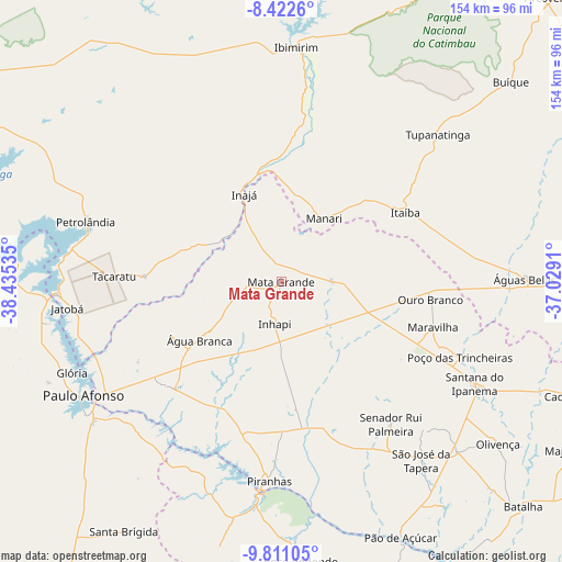
Mata Grande GPS coordinates[2]
9° 7' 3" South, 37° 43' 55.992" West
| Map corner | latitude | longitude |
|---|---|---|
| Upper-left | -8.4226°, | -38.43535° |
| Center: | -9.1175°, | -37.73222° |
| Lower-right: | -9.81105°, | -37.0291° |
| Map W x H: | 154.4×154.4 km | = 95.9×95.9mi |
| max Lat: | 2.81972° ⇑29.2% North |
| Mata Grande: | -9.1175° |
| min Lat: | ⇓70.8% South -33.69111° |
| min Long | Mata Grande | max Long |
| -72.89583° | -37.73222° | -32.41083° |
| W 85.7%⇐ | ⇒14.3% E |
Elevation
Elevation of Mata Grande is 624 m = 2047 ft, and this is 243.1 m = 798 ft above average elevation for this country.
| Max E: |
1603 m = 5259 ft | 25.2% |
| Mata Grande | 624 m 2047 ft | |
| Avg. | 380.9 m = 1250 ft | |
Min E: |
0 m = 0 ft | 74.8% |
See also: Brazil elevation on elevation.city.
Geographical zone
Mata Grande is located in South Torrid zone (between Equator and Tropic of Capricorn). Distance of Equator is 1013.8 km =629.9 mi to North.| Distance of | km | miles | from Mata Grande |
|---|---|---|---|
| Equator | 1013.8 | 629.9 | to North |
| Tropic Capricorn | 1592.1 | 989.3 | to South |
| Antarctic Circle | 6387.4 | 3968.9 | to South |
| South Pole | 8993.3 | 5588.2 | to South |


Nearby cities:
15 places around Mata Grande: (largest is in red/bold)
• Canindé de São Francisco
60.6 km =37.7 mi,  185°
185°
• Carnaíba
47 km =29.2 mi,  8°
8°
• Delmiro Gouveia
42 km =26.1 mi,  224°
224°
• Ibimirim
64.3 km =40 mi,  4°
4°
• Inhapi
11.7 km =7.3 mi, 188°
• Itaíba
38.9 km =24.2 mi,  60°
60°
• Jatobá
59.4 km =36.9 mi,  262°
262°
• Olivença
74.3 km =46.2 mi,  126°
126°
• Paulo Afonso
61.9 km =38.5 mi,  238°
238°
• Poço das Trincheiras
53.6 km =33.3 mi,  113°
113°
• Santana do Ipanema
60.8 km =37.8 mi,  118°
118°
• São José da Tapera
62.3 km =38.7 mi,  141°
141°
• Tupanatinga
59.1 km =36.7 mi,  46°
46°
• Água Branca
27.5 km =17.1 mi,  234°
234°
• Águas Belas
66.9 km =41.6 mi,  89°
89°
Sources, notices
• [Note1] Compared only with cities in Brazil existing in our database
• [Src1] Map data: © OpenStreetMap contributors (CC-BY-SA)
• [Src2] Other city data from geonames.org with taken over terms of usage.
• [Src3] Geographical zone / Annual Mean Temperature by Robert A. Rohde @ Wikipedia
