Carnaíba geodata
Carnaíba (Pernambuco) is a populated place; located in Brazil in America/Recife (GMT-3) time zone. With population of 6,019 people, there are 1877 cities with bigger population in this country. Compared to other cities in Brazil, 72.4% of cities are located further ↓South; 85.9% of cities are located further ←West and 52.1% of cities have lower elevation than Carnaíba. Note1


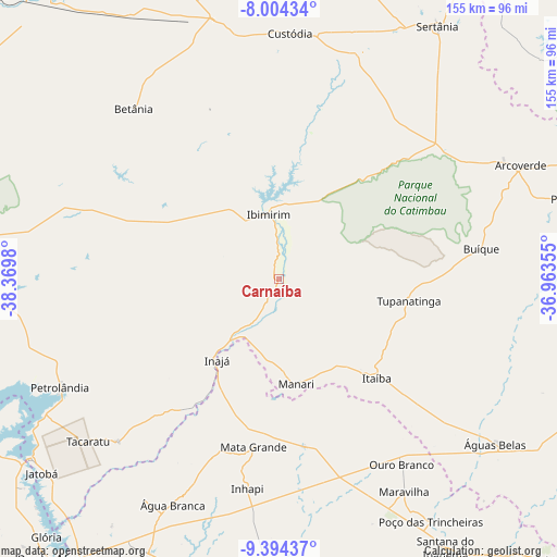
Carnaíba GPS coordinates[2]
8° 42' 0" South, 37° 40' 0.012" West
| Map corner | latitude | longitude |
|---|---|---|
| Upper-left | -8.00434°, | -38.3698° |
| Center: | -8.7°, | -37.66667° |
| Lower-right: | -9.39437°, | -36.96355° |
| Map W x H: | 154.6×154.6 km | = 96.1×96.1mi |
| max Lat: | 2.81972° ⇑27.6% North |
| Carnaíba: | -8.7° |
| min Lat: | ⇓72.4% South -33.69111° |
| min Long | Carnaíba | max Long |
| -72.89583° | -37.66667° | -32.41083° |
| W 85.9%⇐ | ⇒14.1% E |
Elevation
Elevation of Carnaíba is 379 m = 1243 ft, and this is 1.9 m = 6 ft below average elevation for this country.
| Max E: |
1603 m = 5259 ft | 47.9% |
| Avg. | 380.9 m = 1250 ft | |
| Carnaíba | 379 m = 1243 ft | |
Min E: |
0 m = 0 ft | 52.1% |
See also: Brazil elevation on elevation.city.
Geographical zone
Carnaíba is located in South Torrid zone (between Equator and Tropic of Capricorn). Distance of Equator is 967.3 km =601.1 mi to North.| Distance of | km | miles | from Carnaíba |
|---|---|---|---|
| Equator | 967.3 | 601.1 | to North |
| Tropic Capricorn | 1638.6 | 1018.2 | to South |
| Antarctic Circle | 6433.8 | 3997.8 | to South |
| South Pole | 9039.7 | 5617 | to South |


Nearby cities:
15 places around Carnaíba: (largest is in red/bold)
• Arcoverde
74.3 km =46.2 mi,  65°
65°
• Buíque
56.8 km =35.3 mi,  81°
81°
• Custódia
68.2 km =42.4 mi,  2°
2°
• Delmiro Gouveia
84.8 km =52.7 mi,  205°
205°
• Ibimirim
17.9 km =11.1 mi,  351°
351°
• Inhapi
58.7 km =36.5 mi,  188°
188°
• Itaíba
38.4 km =23.9 mi,  135°
135°
• Jatobá
85.2 km =52.9 mi,  230°
230°
• Mata Grande
47 km =29.2 mi, 188°
• Pedra
82.9 km =51.5 mi, 74°
• Poço das Trincheiras
79.9 km =49.6 mi,  148°
148°
• Sertânia
82.5 km =51.3 mi,  32°
32°
• Tupanatinga
36.4 km =22.6 mi,  99°
99°
• Água Branca
69 km =42.9 mi, 205°
• Águas Belas
75.2 km =46.7 mi,  127°
127°
Sources, notices
• [Note1] Compared only with cities in Brazil existing in our database
• [Src1] Map data: © OpenStreetMap contributors (CC-BY-SA)
• [Src2] Other city data from geonames.org with taken over terms of usage.
• [Src3] Geographical zone / Annual Mean Temperature by Robert A. Rohde @ Wikipedia
