Gameleira geodata
Gameleira (Pernambuco) is a populated place; located in Brazil in America/Recife (GMT-3) time zone. With population of 19,423 people, there are 966 cities with bigger population in this country. Compared to other cities in Brazil, 72.9% of cities are located further ↓South; 96.8% of cities are located further ←West and 72.3% of cities have higher elevation than Gameleira. Note1


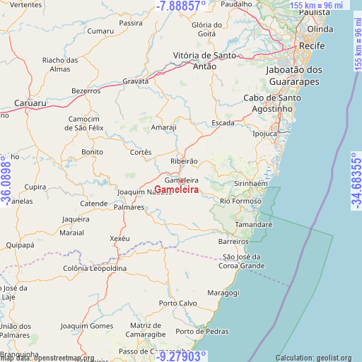
Gameleira GPS coordinates[2]
8° 35' 3.984" South, 35° 23' 12.012" West
| Map corner | latitude | longitude |
|---|---|---|
| Upper-left | -7.88857°, | -36.0898° |
| Center: | -8.58444°, | -35.38667° |
| Lower-right: | -9.27903°, | -34.68355° |
| Map W x H: | 154.6×154.6 km | = 96.1×96.1mi |
| max Lat: | 2.81972° ⇑27.1% North |
| Gameleira: | -8.58444° |
| min Lat: | ⇓72.9% South -33.69111° |
| min Long | Gameleira | max Long |
| -72.89583° | -35.38667° | -32.41083° |
| W 96.8%⇐ | ⇒3.2% E |
Elevation
Elevation of Gameleira is 100 m = 328 ft, and this is 280.9 m = 922 ft below average elevation for this country.
| Max E: |
1603 m = 5259 ft | 72.3% |
| Avg. | 380.9 m = 1250 ft | |
| Gameleira | 100 m = 328 ft | |
Min E: |
0 m = 0 ft | 27.7% |
See also: Brazil elevation on elevation.city.
Geographical zone
Gameleira is located in South Torrid zone (between Equator and Tropic of Capricorn). Distance of Equator is 954.5 km =593.1 mi to North.| Distance of | km | miles | from Gameleira |
|---|---|---|---|
| Equator | 954.5 | 593.1 | to North |
| Tropic Capricorn | 1651.4 | 1026.1 | to South |
| Antarctic Circle | 6446.7 | 4005.8 | to South |
| South Pole | 9052.6 | 5625 | to South |


Nearby cities:
15 places around Gameleira: (largest is in red/bold)
• Amaraji
23.5 km =14.6 mi,  342°
342°
• Barreiros
34.1 km =21.2 mi,  139°
139°
• Bonito
39.7 km =24.7 mi,  288°
288°
• Catende
37.4 km =23.2 mi,  255°
255°
• Chã Grande
39.4 km =24.5 mi,  347°
347°
• Escada
30.8 km =19.1 mi,  35°
35°
• Guabiraba
36 km =22.4 mi,  301°
301°
• Ipojuca
41.1 km =25.5 mi,  59°
59°
• Joaquim Nabuco
16.7 km =10.4 mi,  254°
254°
• Palmares
25.1 km =15.6 mi,  243°
243°
• Ribeirão
7.8 km =4.8 mi,  7°
7°
• Rio Formoso
26.3 km =16.3 mi,  110°
110°
• Sirinhaém
29.8 km =18.5 mi,  91°
91°
• Tamandaré
36.9 km =22.9 mi,  121°
121°
• Água Preta
20.9 km =13 mi,  229°
229°
Sources, notices
• [Note1] Compared only with cities in Brazil existing in our database
• [Src1] Map data: © OpenStreetMap contributors (CC-BY-SA)
• [Src2] Other city data from geonames.org with taken over terms of usage.
• [Src3] Geographical zone / Annual Mean Temperature by Robert A. Rohde @ Wikipedia
