Cabedelo geodata
Cabedelo (Paraíba) is a populated place; located in Brazil in America/Fortaleza (GMT-3) time zone. With population of 54,839 people, there are 402 cities with bigger population in this country. Compared to other cities in Brazil, 80.8% of cities are located further ↓South; 99.9% of cities are located further ←West and 97.2% of cities have higher elevation than Cabedelo. Note1


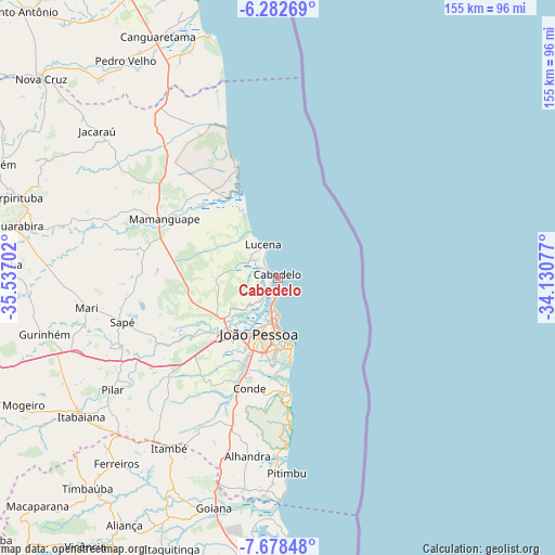
Cabedelo GPS coordinates[2]
6° 58' 51.996" South, 34° 50' 2.004" West
| Map corner | latitude | longitude |
|---|---|---|
| Upper-left | -6.28269°, | -35.53702° |
| Center: | -6.98111°, | -34.83389° |
| Lower-right: | -7.67848°, | -34.13077° |
| Map W x H: | 155.2×155.2 km | = 96.4×96.4mi |
| max Lat: | 2.81972° ⇑19.2% North |
| Cabedelo: | -6.98111° |
| min Lat: | ⇓80.8% South -33.69111° |
| min Long | Cabedelo | max Long |
| -72.89583° | -34.83389° | -32.41083° |
| W 99.9%⇐ | ⇒0.099999999999994% E |
Elevation
Elevation of Cabedelo is 7 m = 23 ft, and this is 373.9 m = 1227 ft below average elevation for this country.
| Max E: |
1603 m = 5259 ft | 97.2% |
| Avg. | 380.9 m = 1250 ft | |
| Cabedelo | 7 m = 23 ft | |
Min E: |
0 m = 0 ft | 2.8% |
See also: Cabedelo elevation on elevation.city.
Geographical zone
Cabedelo is located in South Torrid zone (between Equator and Tropic of Capricorn). Distance of Equator is 776.2 km =482.3 mi to North.| Distance of | km | miles | from Cabedelo |
|---|---|---|---|
| Equator | 776.2 | 482.3 | to North |
| Tropic Capricorn | 1829.7 | 1136.9 | to South |
| Antarctic Circle | 6624.9 | 4116.5 | to South |
| South Pole | 9230.8 | 5735.8 | to South |


Nearby cities:
15 places around Cabedelo: (largest is in red/bold)
• Alhandra
51.6 km =32.1 mi,  189°
189°
• Bayeux
19.3 km =12 mi,  214°
214°
• Caaporã
60 km =37.3 mi, 187°
• Ciceroândia
34.3 km =21.3 mi, 208°
• Conde
32 km =19.9 mi, 194°
• Cruz do Espírito Santo
33 km =20.5 mi,  237°
237°
• João Pessoa
15.2 km =9.4 mi, 192°
• Juripiranga
62.4 km =38.8 mi,  225°
225°
• Mamanguape
35.9 km =22.3 mi,  296°
296°
• Mari
54.3 km =33.7 mi,  260°
260°
• Pedras de Fogo
56.2 km =34.9 mi, 213°
• Pilar
56.8 km =35.3 mi, 235°
• Pitimbu
54.5 km =33.9 mi,  177°
177°
• Rio Tinto
33.7 km =20.9 mi,  306°
306°
• Santa Rita
21.7 km =13.5 mi, 227°
Sources, notices
• [Note1] Compared only with cities in Brazil existing in our database
• [Src1] Map data: © OpenStreetMap contributors (CC-BY-SA)
• [Src2] Other city data from geonames.org with taken over terms of usage.
• [Src3] Geographical zone / Annual Mean Temperature by Robert A. Rohde @ Wikipedia
