Tupanciretã geodata
Tupanciretã (Rio Grande do Sul) is a populated place; located in Brazil in America/Sao_Paulo (GMT-3) time zone. With population of 17,488 people, there are 1067 cities with bigger population in this country. Compared to other cities in Brazil, 96% of cities are located further ↑North; 92.2% of cities are located further →East and 59% of cities have lower elevation than Tupanciretã. Note1


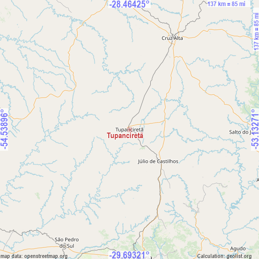
Tupanciretã GPS coordinates[2]
29° 4' 50.016" South, 53° 50' 8.988" West
| Map corner | latitude | longitude |
|---|---|---|
| Upper-left | -28.46425°, | -54.53896° |
| Center: | -29.08056°, | -53.83583° |
| Lower-right: | -29.69321°, | -53.13271° |
| Map W x H: | 136.6×136.6 km | = 84.9×84.9mi |
| max Lat: | 2.81972° ⇑96% North |
| Tupanciretã: | -29.08056° |
| min Lat: | ⇓4% South -33.69111° |
| min Long | Tupanciretã | max Long |
| -72.89583° | -53.83583° | -32.41083° |
| W 7.8%⇐ | ⇒92.2% E |
Elevation
Elevation of Tupanciretã is 464 m = 1522 ft, and this is 83.1 m = 273 ft above average elevation for this country.
| Max E: |
1603 m = 5259 ft | 41% |
| Tupanciretã | 464 m 1522 ft | |
| Avg. | 380.9 m = 1250 ft | |
Min E: |
0 m = 0 ft | 59% |
See also: Brazil elevation on elevation.city.
Geographical zone
Tupanciretã is located in South temperate zone (between Tropic of Capricorn and the Antarctic Circle). Distance of this Southern Tropic circle is 627.5 km =389.9 mi to North.| Distance of | km | miles | from Tupanciretã |
|---|---|---|---|
| Equator | 3233.5 | 2009.2 | to North |
| Tropic Capricorn | 627.5 | 389.9 | to North |
| Antarctic Circle | 4167.7 | 2589.7 | to South |
| South Pole | 6773.6 | 4208.9 | to South |


Nearby cities:
15 places around Tupanciretã: (largest is in red/bold)
• Cacequi
130.9 km =81.3 mi,  226°
226°
• Candelária
120.7 km =75 mi,  122°
122°
• Cruz Alta
53.4 km =33.2 mi,  24°
24°
• Espumoso
103.8 km =64.5 mi,  67°
67°
• Giruá
127.3 km =79.1 mi,  336°
336°
• Ibirubá
88.4 km =54.9 mi,  55°
55°
• Ijuí
77.4 km =48.1 mi,  354°
354°
• Júlio de Castilhos
22.1 km =13.7 mi,  137°
137°
• Não Me Toque
120.7 km =75 mi, 55°
• Panambi
93.5 km =58.1 mi, 20°
• Santa Maria
67.2 km =41.8 mi,  177°
177°
• Santiago
100.9 km =62.7 mi,  262°
262°
• Santo Ângelo
96.4 km =59.9 mi,  334°
334°
• São Pedro do Sul
68.6 km =42.6 mi,  208°
208°
• São Sepé
122.9 km =76.4 mi,  167°
167°
Sources, notices
• [Note1] Compared only with cities in Brazil existing in our database
• [Src1] Map data: © OpenStreetMap contributors (CC-BY-SA)
• [Src2] Other city data from geonames.org with taken over terms of usage.
• [Src3] Geographical zone / Annual Mean Temperature by Robert A. Rohde @ Wikipedia
