São Sepé geodata
São Sepé (Rio Grande do Sul) is a populated place; located in Brazil in America/Sao_Paulo (GMT-3) time zone. With population of 19,181 people, there are 973 cities with bigger population in this country. Compared to other cities in Brazil, 98.9% of cities are located further ↑North; 91.7% of cities are located further →East and 72.8% of cities have higher elevation than São Sepé. Note1


São Sepé GPS coordinates[2]
30° 9' 38.016" South, 53° 33' 55.008" West
| Map corner | latitude | longitude |
|---|---|---|
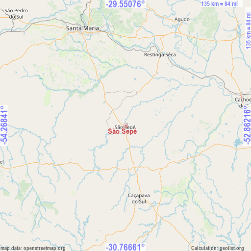
| Upper-left | -29.55076°, | -54.26841° |
| Center: | -30.16056°, | -53.56528° |
| Lower-right: | -30.76661°, | -52.86216° |
| Map W x H: | 135.2×135.2 km | = 84×84mi |
| max Lat: | 2.81972° ⇑98.9% North |
| São Sepé: | -30.16056° |
| min Lat: | ⇓1.1% South -33.69111° |
| min Long | São Sepé | max Long |
| -72.89583° | -53.56528° | -32.41083° |
| W 8.3%⇐ | ⇒91.7% E |
Elevation
Elevation of São Sepé is 96 m = 315 ft, and this is 284.9 m = 935 ft below average elevation for this country.
| Max E: |
1603 m = 5259 ft | 72.8% |
| Avg. | 380.9 m = 1250 ft | |
| São Sepé | 96 m = 315 ft | |
Min E: |
0 m = 0 ft | 27.2% |
See also: Brazil elevation on elevation.city.
Geographical zone
São Sepé is located in South temperate zone (between Tropic of Capricorn and the Antarctic Circle). Distance of this Southern Tropic circle is 747.6 km =464.5 mi to North.| Distance of | km | miles | from São Sepé |
|---|---|---|---|
| Equator | 3353.5 | 2083.8 | to North |
| Tropic Capricorn | 747.6 | 464.5 | to North |
| Antarctic Circle | 4047.6 | 2515.1 | to South |
| South Pole | 6653.5 | 4134.3 | to South |


Nearby cities:
15 places around São Sepé: (largest is in red/bold)
• Cacequi
125.1 km =77.7 mi,  284°
284°
• Cachoeira do Sul
66 km =41 mi,  78°
78°
• Candelária
92.6 km =57.5 mi,  53°
53°
• Caçapava do Sul
40.1 km =24.9 mi,  168°
168°
• Dom Pedrito
140 km =87 mi,  229°
229°
• Encruzilhada do Sul
108.8 km =67.6 mi,  113°
113°
• Júlio de Castilhos
104.4 km =64.9 mi,  353°
353°
• Pinheiros
90.4 km =56.2 mi,  62°
62°
• Rio Pardo
115.8 km =72 mi, 80°
• Rosário do Sul
130.1 km =80.8 mi,  265°
265°
• Santa Cruz do Sul
120.3 km =74.8 mi,  65°
65°
• Santa Maria
57.9 km =36 mi,  336°
336°
• São Gabriel
75.1 km =46.7 mi,  254°
254°
• São Pedro do Sul
84.3 km =52.4 mi,  315°
315°
• Tupanciretã
122.9 km =76.4 mi, 347°
Sources, notices
• [Note1] Compared only with cities in Brazil existing in our database
• [Src1] Map data: © OpenStreetMap contributors (CC-BY-SA)
• [Src2] Other city data from geonames.org with taken over terms of usage.
• [Src3] Geographical zone / Annual Mean Temperature by Robert A. Rohde @ Wikipedia
