Pinheiros geodata
Pinheiros (Rio Grande do Sul) is a populated place; located in Brazil in America/Sao_Paulo (GMT-3) time zone. With population of 1,511 people, there are 2012 cities with bigger population in this country. Compared to other cities in Brazil, 97.9% of cities are located further ↑North; 89.9% of cities are located further →East and 71.9% of cities have higher elevation than Pinheiros. Note1


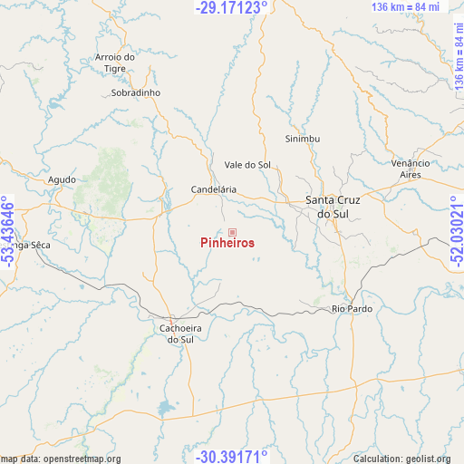
Pinheiros GPS coordinates[2]
29° 46' 59.988" South, 52° 43' 59.988" West
| Map corner | latitude | longitude |
|---|---|---|
| Upper-left | -29.17123°, | -53.43646° |
| Center: | -29.78333°, | -52.73333° |
| Lower-right: | -30.39171°, | -52.03021° |
| Map W x H: | 135.7×135.7 km | = 84.3×84.3mi |
| max Lat: | 2.81972° ⇑97.9% North |
| Pinheiros: | -29.78333° |
| min Lat: | ⇓2.1% South -33.69111° |
| min Long | Pinheiros | max Long |
| -72.89583° | -52.73333° | -32.41083° |
| W 10.1%⇐ | ⇒89.9% E |
Elevation
Elevation of Pinheiros is 107 m = 351 ft, and this is 273.9 m = 899 ft below average elevation for this country.
| Max E: |
1603 m = 5259 ft | 71.9% |
| Avg. | 380.9 m = 1250 ft | |
| Pinheiros | 107 m = 351 ft | |
Min E: |
0 m = 0 ft | 28.1% |
See also: Brazil elevation on elevation.city.
Geographical zone
Pinheiros is located in South temperate zone (between Tropic of Capricorn and the Antarctic Circle). Distance of this Southern Tropic circle is 705.7 km =438.5 mi to North.| Distance of | km | miles | from Pinheiros |
|---|---|---|---|
| Equator | 3311.6 | 2057.7 | to North |
| Tropic Capricorn | 705.7 | 438.5 | to North |
| Antarctic Circle | 4089.6 | 2541.2 | to South |
| South Pole | 6695.5 | 4160.4 | to South |


Nearby cities:
15 places around Pinheiros: (largest is in red/bold)
• Arroio do Meio
87.3 km =54.2 mi,  60°
60°
• Arroio dos Ratos
102.1 km =63.4 mi,  108°
108°
• Butiá
83.2 km =51.7 mi,  116°
116°
• Cachoeira do Sul
32.4 km =20.1 mi,  208°
208°
• Candelária
13.8 km =8.6 mi,  337°
337°
• Encruzilhada do Sul
87 km =54.1 mi,  166°
166°
• Lajeado
82.5 km =51.3 mi, 64°
• Rio Pardo
41.2 km =25.6 mi, 123°
• Santa Cruz do Sul
30.6 km =19 mi,  76°
76°
• São Jerônimo
99.4 km =61.8 mi,  101°
101°
• São Sepé
90.4 km =56.2 mi,  242°
242°
• Taquari
83.9 km =52.1 mi,  91°
91°
• Teutônia
97 km =60.3 mi,  67°
67°
• Triunfo
99.5 km =61.8 mi, 100°
• Venâncio Aires
55.9 km =34.7 mi, 69°
Sources, notices
• [Note1] Compared only with cities in Brazil existing in our database
• [Src1] Map data: © OpenStreetMap contributors (CC-BY-SA)
• [Src2] Other city data from geonames.org with taken over terms of usage.
• [Src3] Geographical zone / Annual Mean Temperature by Robert A. Rohde @ Wikipedia
