São Gabriel geodata
São Gabriel (Rio Grande do Sul) is a populated place; located in Brazil in America/Sao_Paulo (GMT-3) time zone. With population of 55,434 people, there are 395 cities with bigger population in this country. Compared to other cities in Brazil, 99.1% of cities are located further ↑North; 93.2% of cities are located further →East and 70.5% of cities have higher elevation than São Gabriel. Note1


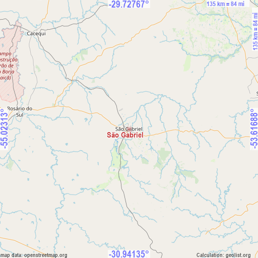
São Gabriel GPS coordinates[2]
30° 20' 11.004" South, 54° 19' 12" West
| Map corner | latitude | longitude |
|---|---|---|
| Upper-left | -29.72767°, | -55.02313° |
| Center: | -30.33639°, | -54.32° |
| Lower-right: | -30.94135°, | -53.61688° |
| Map W x H: | 134.9×134.9 km | = 83.8×83.8mi |
| max Lat: | 2.81972° ⇑99.1% North |
| São Gabriel: | -30.33639° |
| min Lat: | ⇓0.9% South -33.69111° |
| min Long | São Gabriel | max Long |
| -72.89583° | -54.32° | -32.41083° |
| W 6.8%⇐ | ⇒93.2% E |
Elevation
Elevation of São Gabriel is 119 m = 390 ft, and this is 261.9 m = 859 ft below average elevation for this country.
| Max E: |
1603 m = 5259 ft | 70.5% |
| Avg. | 380.9 m = 1250 ft | |
| São Gabriel | 119 m = 390 ft | |
Min E: |
0 m = 0 ft | 29.5% |
See also: São Gabriel elevation on elevation.city.
Geographical zone
São Gabriel is located in South temperate zone (between Tropic of Capricorn and the Antarctic Circle). Distance of this Southern Tropic circle is 767.2 km =476.7 mi to North.| Distance of | km | miles | from São Gabriel |
|---|---|---|---|
| Equator | 3373.1 | 2095.9 | to North |
| Tropic Capricorn | 767.2 | 476.7 | to North |
| Antarctic Circle | 4028.1 | 2502.9 | to South |
| South Pole | 6634 | 4122.2 | to South |


Nearby cities:
15 places around São Gabriel: (largest is in red/bold)
• Alegrete
154.4 km =95.9 mi,  293°
293°
• Bagé
112.5 km =69.9 mi,  169°
169°
• Cacequi
70 km =43.5 mi,  316°
316°
• Cachoeira do Sul
141 km =87.6 mi,  76°
76°
• Caçapava do Sul
82.5 km =51.3 mi,  103°
103°
• Dom Pedrito
79.4 km =49.3 mi,  205°
205°
• Júlio de Castilhos
137.9 km =85.7 mi,  26°
26°
• Rosário do Sul
57.7 km =35.9 mi,  278°
278°
• Santa Maria
87.7 km =54.5 mi, 34°
• Santana do Livramento
131.4 km =81.6 mi,  242°
242°
• Santiago
137.8 km =85.6 mi,  337°
337°
• São Francisco de Assis
117.2 km =72.8 mi, 318°
• São Pedro do Sul
80.7 km =50.1 mi,  9°
9°
• São Sepé
75.1 km =46.7 mi,  74°
74°
• Tupanciretã
147.3 km =91.5 mi,  18°
18°
Sources, notices
• [Note1] Compared only with cities in Brazil existing in our database
• [Src1] Map data: © OpenStreetMap contributors (CC-BY-SA)
• [Src2] Other city data from geonames.org with taken over terms of usage.
• [Src3] Geographical zone / Annual Mean Temperature by Robert A. Rohde @ Wikipedia
