Sabinópolis geodata
Sabinópolis (Minas Gerais) is a populated place; located in Brazil in America/Sao_Paulo (GMT-3) time zone. With population of 9,713 people, there are 1671 cities with bigger population in this country. Compared to other cities in Brazil, 52.3% of cities are located further ↑North; 59.9% of cities are located further ←West and 81.7% of cities have lower elevation than Sabinópolis. Note1


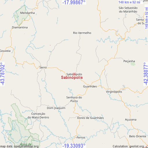
Sabinópolis GPS coordinates[2]
18° 39' 57.996" South, 43° 5' 2.004" West
| Map corner | latitude | longitude |
|---|---|---|
| Upper-left | -17.99867°, | -43.78702° |
| Center: | -18.66611°, | -43.08389° |
| Lower-right: | -19.33093°, | -42.38077° |
| Map W x H: | 148.1×148.1 km | = 92×92mi |
| max Lat: | 2.81972° ⇑52.3% North |
| Sabinópolis: | -18.66611° |
| min Lat: | ⇓47.7% South -33.69111° |
| min Long | Sabinópolis | max Long |
| -72.89583° | -43.08389° | -32.41083° |
| W 59.9%⇐ | ⇒40.1% E |
Elevation
Elevation of Sabinópolis is 714 m = 2343 ft, and this is 333.1 m = 1093 ft above average elevation for this country.
| Max E: |
1603 m = 5259 ft | 18.3% |
| Sabinópolis | 714 m 2343 ft | |
| Avg. | 380.9 m = 1250 ft | |
Min E: |
0 m = 0 ft | 81.7% |
See also: Brazil elevation on elevation.city.
Geographical zone
Sabinópolis is located in South Torrid zone (between Equator and Tropic of Capricorn). Distance of this Southern Tropic circle is 530.4 km =329.6 mi to South.| Distance of | km | miles | from Sabinópolis |
|---|---|---|---|
| Equator | 2075.5 | 1289.7 | to North |
| Tropic Capricorn | 530.4 | 329.6 | to South |
| Antarctic Circle | 5325.7 | 3309.2 | to South |
| South Pole | 7931.6 | 4928.5 | to South |


Nearby cities:
15 places around Sabinópolis: (largest is in red/bold)
• Açucena
72.4 km =45 mi,  128°
128°
• Belo Oriente
88.2 km =54.8 mi, 134°
• Conceição do Mato Dentro
54.7 km =34 mi,  221°
221°
• Coronel Fabriciano
106.2 km =66 mi,  153°
153°
• Diamantina
71.9 km =44.7 mi,  310°
310°
• Guanhães
20 km =12.4 mi, 127°
• Ipaba
108.6 km =67.5 mi,  139°
139°
• Ipatinga
106.1 km =65.9 mi, 147°
• Itabira
107 km =66.5 mi,  188°
188°
• Itamarandiba
93 km =57.8 mi,  14°
14°
• Peçanha
57 km =35.4 mi,  76°
76°
• Santa Maria do Suaçuí
88.3 km =54.9 mi,  53°
53°
• Santana do Paraíso
94.6 km =58.8 mi, 145°
• Serro
31.9 km =19.8 mi,  282°
282°
• São João Evangelista
36.3 km =22.6 mi,  68°
68°
Sources, notices
• [Note1] Compared only with cities in Brazil existing in our database
• [Src1] Map data: © OpenStreetMap contributors (CC-BY-SA)
• [Src2] Other city data from geonames.org with taken over terms of usage.
• [Src3] Geographical zone / Annual Mean Temperature by Robert A. Rohde @ Wikipedia
