Peçanha geodata
Peçanha (Minas Gerais) is a populated place; located in Brazil in America/Sao_Paulo (GMT-3) time zone. With population of 6,902 people, there are 1836 cities with bigger population in this country. Compared to other cities in Brazil, 51.9% of cities are located further ↑North; 63.2% of cities are located further ←West and 87.9% of cities have lower elevation than Peçanha. Note1


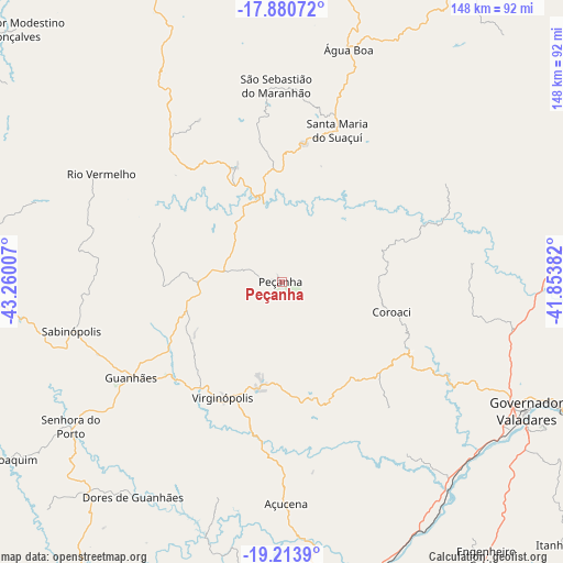
Peçanha GPS coordinates[2]
18° 32' 54.996" South, 42° 33' 24.984" West
| Map corner | latitude | longitude |
|---|---|---|
| Upper-left | -17.88072°, | -43.26007° |
| Center: | -18.54861°, | -42.55694° |
| Lower-right: | -19.2139°, | -41.85382° |
| Map W x H: | 148.2×148.2 km | = 92.1×92.1mi |
| max Lat: | 2.81972° ⇑51.9% North |
| Peçanha: | -18.54861° |
| min Lat: | ⇓48.1% South -33.69111° |
| min Long | Peçanha | max Long |
| -72.89583° | -42.55694° | -32.41083° |
| W 63.2%⇐ | ⇒36.8% E |
Elevation
Elevation of Peçanha is 784 m = 2572 ft, and this is 403.1 m = 1323 ft above average elevation for this country.
| Max E: |
1603 m = 5259 ft | 12.1% |
| Peçanha | 784 m 2572 ft | |
| Avg. | 380.9 m = 1250 ft | |
Min E: |
0 m = 0 ft | 87.9% |
See also: Brazil elevation on elevation.city.
Geographical zone
Peçanha is located in South Torrid zone (between Equator and Tropic of Capricorn). Distance of this Southern Tropic circle is 543.5 km =337.7 mi to South.| Distance of | km | miles | from Peçanha |
|---|---|---|---|
| Equator | 2062.4 | 1281.5 | to North |
| Tropic Capricorn | 543.5 | 337.7 | to South |
| Antarctic Circle | 5338.8 | 3317.4 | to South |
| South Pole | 7944.6 | 4936.5 | to South |


Nearby cities:
15 places around Peçanha: (largest is in red/bold)
• Açucena
58.3 km =36.2 mi,  178°
178°
• Belo Oriente
75 km =46.6 mi,  174°
174°
• Capelinha
95.4 km =59.3 mi,  2°
2°
• Conceição do Mato Dentro
106.3 km =66.1 mi,  239°
239°
• Governador Valadares
72.3 km =44.9 mi,  117°
117°
• Guanhães
46.9 km =29.1 mi, 237°
• Ipaba
97.3 km =60.5 mi, 171°
• Ipatinga
102.3 km =63.6 mi, 178°
• Itamarandiba
83.2 km =51.7 mi,  337°
337°
• Malacacheta
93.5 km =58.1 mi,  32°
32°
• Sabinópolis
57 km =35.4 mi,  256°
256°
• Santa Maria do Suaçuí
42.6 km =26.5 mi,  20°
20°
• Santana do Paraíso
90.6 km =56.3 mi, 180°
• Serro
86.9 km =54 mi,  265°
265°
• São João Evangelista
21.8 km =13.5 mi, 270°
Sources, notices
• [Note1] Compared only with cities in Brazil existing in our database
• [Src1] Map data: © OpenStreetMap contributors (CC-BY-SA)
• [Src2] Other city data from geonames.org with taken over terms of usage.
• [Src3] Geographical zone / Annual Mean Temperature by Robert A. Rohde @ Wikipedia
