Recreio geodata
Recreio (Minas Gerais) is a populated place; located in Brazil in America/Sao_Paulo (GMT-3) time zone. With population of 8,882 people, there are 1723 cities with bigger population in this country. Compared to other cities in Brazil, 66.6% of cities are located further ↑North; 63.8% of cities are located further ←West and 63.6% of cities have higher elevation than Recreio. Note1


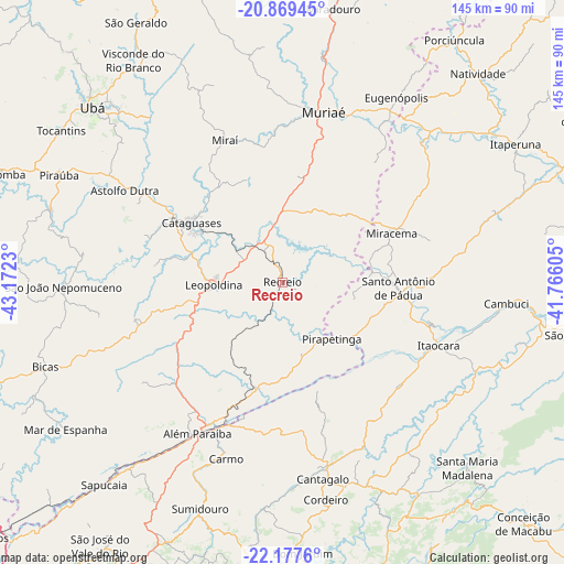
Recreio GPS coordinates[2]
21° 31' 30" South, 42° 28' 9.012" West
| Map corner | latitude | longitude |
|---|---|---|
| Upper-left | -20.86945°, | -43.1723° |
| Center: | -21.525°, | -42.46917° |
| Lower-right: | -22.1776°, | -41.76605° |
| Map W x H: | 145.5×145.5 km | = 90.4×90.4mi |
| max Lat: | 2.81972° ⇑66.6% North |
| Recreio: | -21.525° |
| min Lat: | ⇓33.4% South -33.69111° |
| min Long | Recreio | max Long |
| -72.89583° | -42.46917° | -32.41083° |
| W 63.8%⇐ | ⇒36.2% E |
Elevation
Elevation of Recreio is 180 m = 591 ft, and this is 200.9 m = 659 ft below average elevation for this country.
| Max E: |
1603 m = 5259 ft | 63.6% |
| Avg. | 380.9 m = 1250 ft | |
| Recreio | 180 m = 591 ft | |
Min E: |
0 m = 0 ft | 36.4% |
See also: Brazil elevation on elevation.city.
Geographical zone
Recreio is located in South Torrid zone (between Equator and Tropic of Capricorn). Distance of this Southern Tropic circle is 212.6 km =132.1 mi to South.| Distance of | km | miles | from Recreio |
|---|---|---|---|
| Equator | 2393.4 | 1487.2 | to North |
| Tropic Capricorn | 212.6 | 132.1 | to South |
| Antarctic Circle | 5007.8 | 3111.7 | to South |
| South Pole | 7613.7 | 4730.9 | to South |


Nearby cities:
15 places around Recreio: (largest is in red/bold)
• Além Paraíba
47.1 km =29.3 mi,  211°
211°
• Astolfo Dutra
46.9 km =29.1 mi,  299°
299°
• Bicas
64.9 km =40.3 mi,  249°
249°
• Cambuci
58 km =36 mi,  95°
95°
• Cantagalo
51.8 km =32.2 mi,  168°
168°
• Carmo
47.7 km =29.6 mi,  197°
197°
• Cataguases
28 km =17.4 mi, 302°
• Cordeiro
57.1 km =35.5 mi, 168°
• Itaocara
43.7 km =27.2 mi,  111°
111°
• Leopoldina
18 km =11.2 mi,  267°
267°
• Miracema
30.9 km =19.2 mi,  66°
66°
• Miraí
39.6 km =24.6 mi,  337°
337°
• Muriaé
45.1 km =28 mi,  13°
13°
• Santo Antônio de Pádua
29.9 km =18.6 mi,  93°
93°
• São João Nepomuceno
56 km =34.8 mi, 268°
Sources, notices
• [Note1] Compared only with cities in Brazil existing in our database
• [Src1] Map data: © OpenStreetMap contributors (CC-BY-SA)
• [Src2] Other city data from geonames.org with taken over terms of usage.
• [Src3] Geographical zone / Annual Mean Temperature by Robert A. Rohde @ Wikipedia
