Presidente Epitácio geodata
Presidente Epitácio (São Paulo) is a populated place; located in Brazil in America/Sao_Paulo (GMT-3) time zone. With population of 38,742 people, there are 541 cities with bigger population in this country. Compared to other cities in Brazil, 68.4% of cities are located further ↑North; 88.1% of cities are located further →East and 52.7% of cities have higher elevation than Presidente Epitácio. Note1


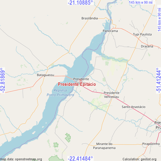
Presidente Epitácio GPS coordinates[2]
21° 45' 47.988" South, 52° 6' 56.016" West
| Map corner | latitude | longitude |
|---|---|---|
| Upper-left | -21.10885°, | -52.81869° |
| Center: | -21.76333°, | -52.11556° |
| Lower-right: | -22.41484°, | -51.41244° |
| Map W x H: | 145.2×145.2 km | = 90.2×90.2mi |
| max Lat: | 2.81972° ⇑68.4% North |
| Presidente Epitácio: | -21.76333° |
| min Lat: | ⇓31.6% South -33.69111° |
| min Long | Presidente Epit | max Long |
| -72.89583° | -52.11556° | -32.41083° |
| W 11.9%⇐ | ⇒88.1% E |
Elevation
Elevation of Presidente Epitácio is 305 m = 1001 ft, and this is 75.9 m = 249 ft below average elevation for this country.
| Max E: |
1603 m = 5259 ft | 52.7% |
| Avg. | 380.9 m = 1250 ft | |
| Presidente Epitácio | 305 m = 1001 ft | |
Min E: |
0 m = 0 ft | 47.3% |
See also: Brazil elevation on elevation.city.
Geographical zone
Presidente Epitácio is located in South Torrid zone (between Equator and Tropic of Capricorn). Distance of this Southern Tropic circle is 186.1 km =115.6 mi to South.| Distance of | km | miles | from Presidente Epitácio |
|---|---|---|---|
| Equator | 2419.9 | 1503.7 | to North |
| Tropic Capricorn | 186.1 | 115.6 | to South |
| Antarctic Circle | 4981.3 | 3095.2 | to South |
| South Pole | 7587.2 | 4714.5 | to South |


Nearby cities:
15 places around Presidente Epitácio: (largest is in red/bold)
• Junqueirópolis
75.7 km =47 mi,  68°
68°
• Martinópolis
106.3 km =66.1 mi,  113°
113°
• Mirante do Paranapanema
62.6 km =38.9 mi,  159°
159°
• Pacaembu
91.1 km =56.6 mi,  75°
75°
• Panorama
52.4 km =32.6 mi,  30°
30°
• Paulista Flórida
96.3 km =59.8 mi, 79°
• Pirapozinho
85.2 km =52.9 mi,  131°
131°
• Presidente Bernardes
64 km =39.8 mi, 114°
• Presidente Prudente
85.1 km =52.9 mi,  118°
118°
• Presidente Venceslau
30.7 km =19.1 mi, 114°
• Regente Feijó
98.1 km =61 mi, 121°
• Santo Anastácio
52.8 km =32.8 mi,  99°
99°
• Teodoro Sampaio
85.7 km =53.3 mi,  183°
183°
• Tupi Paulista
70.6 km =43.9 mi,  52°
52°
• Álvares Machado
75.1 km =46.7 mi, 117°
Sources, notices
• [Note1] Compared only with cities in Brazil existing in our database
• [Src1] Map data: © OpenStreetMap contributors (CC-BY-SA)
• [Src2] Other city data from geonames.org with taken over terms of usage.
• [Src3] Geographical zone / Annual Mean Temperature by Robert A. Rohde @ Wikipedia
