Pacaembu geodata
Pacaembu (São Paulo) is a populated place; located in Brazil in America/Sao_Paulo (GMT-3) time zone. With population of 10,101 people, there are 1640 cities with bigger population in this country. Compared to other cities in Brazil, 67% of cities are located further ↑North; 84.3% of cities are located further →East and 54.7% of cities have lower elevation than Pacaembu. Note1


Pacaembu GPS coordinates[2]
21° 33' 43.992" South, 51° 15' 38.016" West
| Map corner | latitude | longitude |
|---|---|---|
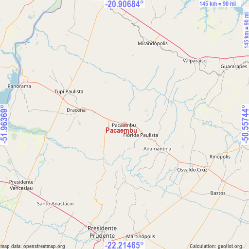
| Upper-left | -20.90684°, | -51.96369° |
| Center: | -21.56222°, | -51.26056° |
| Lower-right: | -22.21465°, | -50.55744° |
| Map W x H: | 145.4×145.4 km | = 90.3×90.3mi |
| max Lat: | 2.81972° ⇑67% North |
| Pacaembu: | -21.56222° |
| min Lat: | ⇓33% South -33.69111° |
| min Long | Pacaembu | max Long |
| -72.89583° | -51.26056° | -32.41083° |
| W 15.7%⇐ | ⇒84.3% E |
Elevation
Elevation of Pacaembu is 417 m = 1368 ft, and this is 36.1 m = 118 ft above average elevation for this country.
| Max E: |
1603 m = 5259 ft | 45.3% |
| Pacaembu | 417 m 1368 ft | |
| Avg. | 380.9 m = 1250 ft | |
Min E: |
0 m = 0 ft | 54.7% |
See also: Brazil elevation on elevation.city.
Geographical zone
Pacaembu is located in South Torrid zone (between Equator and Tropic of Capricorn). Distance of this Southern Tropic circle is 208.4 km =129.5 mi to South.| Distance of | km | miles | from Pacaembu |
|---|---|---|---|
| Equator | 2397.5 | 1489.7 | to North |
| Tropic Capricorn | 208.4 | 129.5 | to South |
| Antarctic Circle | 5003.7 | 3109.2 | to South |
| South Pole | 7609.6 | 4728.4 | to South |


Nearby cities:
15 places around Pacaembu: (largest is in red/bold)
• Adamantina
23.8 km =14.8 mi,  125°
125°
• Bastos
67.5 km =41.9 mi, 126°
• Junqueirópolis
18.7 km =11.6 mi,  286°
286°
• Lucélia
30.5 km =19 mi, 125°
• Martinópolis
65.5 km =40.7 mi,  171°
171°
• Mirandopólis
50.4 km =31.3 mi,  19°
19°
• Osvaldo Cruz
47.3 km =29.4 mi,  123°
123°
• Panorama
66.1 km =41.1 mi, 290°
• Paulista Flórida
7.5 km =4.7 mi, 123°
• Presidente Bernardes
57.9 km =36 mi,  211°
211°
• Presidente Prudente
64 km =39.8 mi,  191°
191°
• Santo Anastácio
47.4 km =29.5 mi,  229°
229°
• Tupi Paulista
37.9 km =23.5 mi,  302°
302°
• Valparaíso
55.1 km =34.2 mi,  47°
47°
• Álvares Machado
61.5 km =38.2 mi,  200°
200°
Sources, notices
• [Note1] Compared only with cities in Brazil existing in our database
• [Src1] Map data: © OpenStreetMap contributors (CC-BY-SA)
• [Src2] Other city data from geonames.org with taken over terms of usage.
• [Src3] Geographical zone / Annual Mean Temperature by Robert A. Rohde @ Wikipedia
