Pradópolis geodata
Pradópolis (São Paulo) is a populated place; located in Brazil in America/Sao_Paulo (GMT-3) time zone. With population of 13,192 people, there are 1357 cities with bigger population in this country. Compared to other cities in Brazil, 65.7% of cities are located further ↑North; 65% of cities are located further →East and 66.4% of cities have lower elevation than Pradópolis. Note1


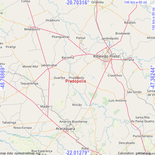
Pradópolis GPS coordinates[2]
21° 21' 33.984" South, 48° 3' 56.016" West
| Map corner | latitude | longitude |
|---|---|---|
| Upper-left | -20.70316°, | -48.76869° |
| Center: | -21.35944°, | -48.06556° |
| Lower-right: | -22.01279°, | -47.36244° |
| Map W x H: | 145.6×145.6 km | = 90.5×90.5mi |
| max Lat: | 2.81972° ⇑65.7% North |
| Pradópolis: | -21.35944° |
| min Lat: | ⇓34.3% South -33.69111° |
| min Long | Pradópolis | max Long |
| -72.89583° | -48.06556° | -32.41083° |
| W 35%⇐ | ⇒65% E |
Elevation
Elevation of Pradópolis is 539 m = 1768 ft, and this is 158.1 m = 519 ft above average elevation for this country.
| Max E: |
1603 m = 5259 ft | 33.6% |
| Pradópolis | 539 m 1768 ft | |
| Avg. | 380.9 m = 1250 ft | |
Min E: |
0 m = 0 ft | 66.4% |
See also: Brazil elevation on elevation.city.
Geographical zone
Pradópolis is located in South Torrid zone (between Equator and Tropic of Capricorn). Distance of this Southern Tropic circle is 231 km =143.5 mi to South.| Distance of | km | miles | from Pradópolis |
|---|---|---|---|
| Equator | 2374.9 | 1475.7 | to North |
| Tropic Capricorn | 231 | 143.5 | to South |
| Antarctic Circle | 5026.2 | 3123.1 | to South |
| South Pole | 7632.1 | 4742.4 | to South |


Nearby cities:
15 places around Pradópolis: (largest is in red/bold)
• Américo Brasiliense
40.8 km =25.4 mi,  185°
185°
• Araraquara
49.7 km =30.9 mi, 193°
• Barrinha
21.1 km =13.1 mi,  331°
331°
• Cravinhos
34.9 km =21.7 mi,  86°
86°
• Guariba
16.9 km =10.5 mi,  269°
269°
• Jaboticabal
29 km =18 mi,  293°
293°
• Jardinópolis
49.2 km =30.6 mi,  39°
39°
• Matão
41.2 km =25.6 mi,  228°
228°
• Monte Alto
45.9 km =28.5 mi,  283°
283°
• Pitangueiras
42.1 km =26.2 mi,  337°
337°
• Pontal
37.6 km =23.4 mi,  4°
4°
• Ribeirão Preto
33.3 km =20.7 mi,  52°
52°
• Serrana
51.4 km =31.9 mi,  71°
71°
• Sertãozinho
25.9 km =16.1 mi,  17°
17°
• Taquaritinga
45.8 km =28.5 mi,  263°
263°
Sources, notices
• [Note1] Compared only with cities in Brazil existing in our database
• [Src1] Map data: © OpenStreetMap contributors (CC-BY-SA)
• [Src2] Other city data from geonames.org with taken over terms of usage.
• [Src3] Geographical zone / Annual Mean Temperature by Robert A. Rohde @ Wikipedia
