Venâncio Aires geodata
Venâncio Aires (Rio Grande do Sul) is a populated place; located in Brazil in America/Sao_Paulo (GMT-3) time zone. With population of 40,627 people, there are 522 cities with bigger population in this country. Compared to other cities in Brazil, 97.1% of cities are located further ↑North; 88.2% of cities are located further →East and 80.8% of cities have higher elevation than Venâncio Aires. Note1


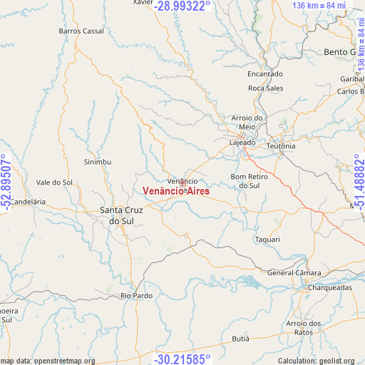
Venâncio Aires GPS coordinates[2]
29° 36' 23.004" South, 52° 11' 30.984" West
| Map corner | latitude | longitude |
|---|---|---|
| Upper-left | -28.99322°, | -52.89507° |
| Center: | -29.60639°, | -52.19194° |
| Lower-right: | -30.21585°, | -51.48882° |
| Map W x H: | 135.9×135.9 km | = 84.4×84.4mi |
| max Lat: | 2.81972° ⇑97.1% North |
| Venâncio Aires: | -29.60639° |
| min Lat: | ⇓2.9% South -33.69111° |
| min Long | Venâncio Aires | max Long |
| -72.89583° | -52.19194° | -32.41083° |
| W 11.8%⇐ | ⇒88.2% E |
Elevation
Elevation of Venâncio Aires is 43 m = 141 ft, and this is 337.9 m = 1109 ft below average elevation for this country.
| Max E: |
1603 m = 5259 ft | 80.8% |
| Avg. | 380.9 m = 1250 ft | |
| Venâncio Aires | 43 m = 141 ft | |
Min E: |
0 m = 0 ft | 19.2% |
See also: Venâncio Aires elevation on elevation.city.
Geographical zone
Venâncio Aires is located in South temperate zone (between Tropic of Capricorn and the Antarctic Circle). Distance of this Southern Tropic circle is 686 km =426.3 mi to North.| Distance of | km | miles | from Venâncio Aires |
|---|---|---|---|
| Equator | 3291.9 | 2045.5 | to North |
| Tropic Capricorn | 686 | 426.3 | to North |
| Antarctic Circle | 4109.3 | 2553.4 | to South |
| South Pole | 6715.1 | 4172.6 | to South |


Nearby cities:
15 places around Venâncio Aires: (largest is in red/bold)
• Arroio do Meio
33 km =20.5 mi,  46°
46°
• Arroio dos Ratos
68.8 km =42.8 mi,  139°
139°
• Butiá
61.2 km =38 mi,  158°
158°
• Candelária
58.1 km =36.1 mi,  263°
263°
• Charqueadas
67 km =41.6 mi,  125°
125°
• Encantado
51.7 km =32.1 mi,  37°
37°
• Lajeado
27.2 km =16.9 mi,  55°
55°
• Montenegro
71.2 km =44.2 mi,  97°
97°
• Pinheiros
55.9 km =34.7 mi,  249°
249°
• Rio Pardo
46.3 km =28.8 mi,  202°
202°
• Santa Cruz do Sul
25.8 km =16 mi,  241°
241°
• São Jerônimo
59.9 km =37.2 mi, 130°
• Taquari
38.2 km =23.7 mi,  124°
124°
• Teutônia
41.2 km =25.6 mi, 64°
• Triunfo
59.1 km =36.7 mi, 129°
Sources, notices
• [Note1] Compared only with cities in Brazil existing in our database
• [Src1] Map data: © OpenStreetMap contributors (CC-BY-SA)
• [Src2] Other city data from geonames.org with taken over terms of usage.
• [Src3] Geographical zone / Annual Mean Temperature by Robert A. Rohde @ Wikipedia
