Mirandopólis geodata
Mirandopólis (São Paulo) is a populated place; located in Brazil in America/Sao_Paulo (GMT-3) time zone. With population of 23,378 people, there are 822 cities with bigger population in this country. Compared to other cities in Brazil, 63.9% of cities are located further ↑North; 83% of cities are located further →East and 56.6% of cities have lower elevation than Mirandopólis. Note1


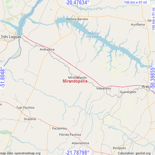
Mirandopólis GPS coordinates[2]
21° 8' 0.996" South, 51° 6' 6.012" West
| Map corner | latitude | longitude |
|---|---|---|
| Upper-left | -20.47634°, | -51.8048° |
| Center: | -21.13361°, | -51.10167° |
| Lower-right: | -21.78798°, | -50.39855° |
| Map W x H: | 145.8×145.8 km | = 90.6×90.6mi |
| max Lat: | 2.81972° ⇑63.9% North |
| Mirandopólis: | -21.13361° |
| min Lat: | ⇓36.1% South -33.69111° |
| min Long | Mirandopólis | max Long |
| -72.89583° | -51.10167° | -32.41083° |
| W 17%⇐ | ⇒83% E |
Elevation
Elevation of Mirandopólis is 438 m = 1437 ft, and this is 57.1 m = 187 ft above average elevation for this country.
| Max E: |
1603 m = 5259 ft | 43.4% |
| Mirandopólis | 438 m 1437 ft | |
| Avg. | 380.9 m = 1250 ft | |
Min E: |
0 m = 0 ft | 56.6% |
See also: Brazil elevation on elevation.city.
Geographical zone
Mirandopólis is located in South Torrid zone (between Equator and Tropic of Capricorn). Distance of this Southern Tropic circle is 256.1 km =159.1 mi to South.| Distance of | km | miles | from Mirandopólis |
|---|---|---|---|
| Equator | 2349.8 | 1460.1 | to North |
| Tropic Capricorn | 256.1 | 159.1 | to South |
| Antarctic Circle | 5051.3 | 3138.7 | to South |
| South Pole | 7657.2 | 4758 | to South |


Nearby cities:
15 places around Mirandopólis: (largest is in red/bold)
• Adamantina
61.4 km =38.2 mi,  177°
177°
• Andradina
39.1 km =24.3 mi,  312°
312°
• Araçatuba
69.9 km =43.4 mi,  96°
96°
• Auriflama
75.6 km =47 mi,  48°
48°
• Castilho
49.5 km =30.8 mi, 305°
• Guararapes
49.6 km =30.8 mi,  106°
106°
• Junqueirópolis
54.6 km =33.9 mi,  219°
219°
• Lucélia
65.8 km =40.9 mi,  172°
172°
• Osvaldo Cruz
77.3 km =48 mi,  162°
162°
• Pacaembu
50.4 km =31.3 mi,  199°
199°
• Paulista Flórida
52.8 km =32.8 mi,  191°
191°
• Pereira Barreto
55.1 km =34.2 mi,  359°
359°
• Três Lagoas
73.4 km =45.6 mi,  301°
301°
• Tupi Paulista
55.8 km =34.7 mi,  240°
240°
• Valparaíso
26.4 km =16.4 mi, 113°
Sources, notices
• [Note1] Compared only with cities in Brazil existing in our database
• [Src1] Map data: © OpenStreetMap contributors (CC-BY-SA)
• [Src2] Other city data from geonames.org with taken over terms of usage.
• [Src3] Geographical zone / Annual Mean Temperature by Robert A. Rohde @ Wikipedia
