Otacílio Costa geodata
Otacílio Costa (Santa Catarina) is a populated place; located in Brazil in America/Sao_Paulo (GMT-3) time zone. With population of 14,557 people, there are 1244 cities with bigger population in this country. Compared to other cities in Brazil, 92.1% of cities are located further ↑North; 78.8% of cities are located further →East and 93.7% of cities have lower elevation than Otacílio Costa. Note1


Otacílio Costa GPS coordinates[2]
27° 28' 59.016" South, 50° 7' 18.984" West
| Map corner | latitude | longitude |
|---|---|---|
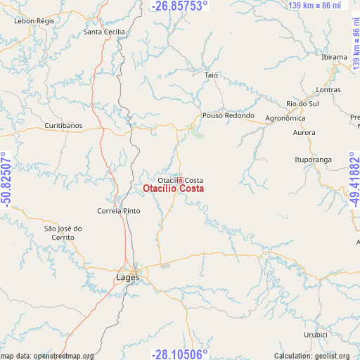
| Upper-left | -26.85753°, | -50.82507° |
| Center: | -27.48306°, | -50.12194° |
| Lower-right: | -28.10506°, | -49.41882° |
| Map W x H: | 138.7×138.7 km | = 86.2×86.2mi |
| max Lat: | 2.81972° ⇑92.1% North |
| Otacílio Costa: | -27.48306° |
| min Lat: | ⇓7.9% South -33.69111° |
| min Long | Otacílio Costa | max Long |
| -72.89583° | -50.12194° | -32.41083° |
| W 21.2%⇐ | ⇒78.8% E |
Elevation
Elevation of Otacílio Costa is 877 m = 2877 ft, and this is 496.1 m = 1628 ft above average elevation for this country.
| Max E: |
1603 m = 5259 ft | 6.3% |
| Otacílio Costa | 877 m 2877 ft | |
| Avg. | 380.9 m = 1250 ft | |
Min E: |
0 m = 0 ft | 93.7% |
See also: Brazil elevation on elevation.city.
Geographical zone
Otacílio Costa is located in South temperate zone (between Tropic of Capricorn and the Antarctic Circle). Distance of this Southern Tropic circle is 449.9 km =279.6 mi to North.| Distance of | km | miles | from Otacílio Costa |
|---|---|---|---|
| Equator | 3055.8 | 1898.8 | to North |
| Tropic Capricorn | 449.9 | 279.6 | to North |
| Antarctic Circle | 4345.3 | 2700 | to South |
| South Pole | 6951.2 | 4319.3 | to South |


Nearby cities:
15 places around Otacílio Costa: (largest is in red/bold)
• Anitápolis
108.3 km =67.3 mi,  115°
115°
• Campos Novos
109.2 km =67.9 mi,  274°
274°
• Correia Pinto
26.2 km =16.3 mi,  244°
244°
• Curitibanos
50.8 km =31.6 mi,  295°
295°
• Estrela
102.9 km =63.9 mi,  231°
231°
• Ibirama
76.2 km =47.3 mi,  51°
51°
• Indaial
109.5 km =68 mi, 53°
• Lages
42.1 km =26.2 mi,  208°
208°
• Residencia Moacir PU5BHV
98.3 km =61.1 mi, 49°
• Rio do Sul
56 km =34.8 mi,  57°
57°
• Rodeio
97.3 km =60.5 mi, 50°
• Santa Cecília
65.4 km =40.6 mi,  332°
332°
• São Joaquim
92.1 km =57.2 mi,  168°
168°
• Timbó
111.6 km =69.3 mi, 48°
• Videira
114.7 km =71.3 mi, 297°
Sources, notices
• [Note1] Compared only with cities in Brazil existing in our database
• [Src1] Map data: © OpenStreetMap contributors (CC-BY-SA)
• [Src2] Other city data from geonames.org with taken over terms of usage.
• [Src3] Geographical zone / Annual Mean Temperature by Robert A. Rohde @ Wikipedia
