Lages geodata
Lages (Santa Catarina) is a populated place; located in Brazil in America/Sao_Paulo (GMT-3) time zone. With population of 164,676 people, there are 139 cities with bigger population in this country. Compared to other cities in Brazil, 93.6% of cities are located further ↑North; 79.6% of cities are located further →East and 96.1% of cities have lower elevation than Lages. Note1


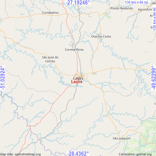
Lages GPS coordinates[2]
27° 48' 57.996" South, 50° 19' 33.996" West
| Map corner | latitude | longitude |
|---|---|---|
| Upper-left | -27.19246°, | -51.02924° |
| Center: | -27.81611°, | -50.32611° |
| Lower-right: | -28.4362°, | -49.62299° |
| Map W x H: | 138.3×138.3 km | = 85.9×85.9mi |
| max Lat: | 2.81972° ⇑93.6% North |
| Lages: | -27.81611° |
| min Lat: | ⇓6.4% South -33.69111° |
| min Long | Lages | max Long |
| -72.89583° | -50.32611° | -32.41083° |
| W 20.4%⇐ | ⇒79.6% E |
Elevation
Elevation of Lages is 917 m = 3009 ft, and this is 536.1 m = 1759 ft above average elevation for this country.
| Max E: |
1603 m = 5259 ft | 3.9% |
| Lages | 917 m 3009 ft | |
| Avg. | 380.9 m = 1250 ft | |
Min E: |
0 m = 0 ft | 96.1% |
See also: Lages elevation on elevation.city.
Geographical zone
Lages is located in South temperate zone (between Tropic of Capricorn and the Antarctic Circle). Distance of this Southern Tropic circle is 486.9 km =302.5 mi to North.| Distance of | km | miles | from Lages |
|---|---|---|---|
| Equator | 3092.9 | 1921.8 | to North |
| Tropic Capricorn | 486.9 | 302.5 | to North |
| Antarctic Circle | 4308.3 | 2677.1 | to South |
| South Pole | 6914.2 | 4296.3 | to South |


Nearby cities:
15 places around Lages: (largest is in red/bold)
• Anitápolis
118.1 km =73.4 mi,  94°
94°
• Campos Novos
99.8 km =62 mi,  297°
297°
• Celso Ramos
101.5 km =63.1 mi,  281°
281°
• Correia Pinto
26 km =16.2 mi,  352°
352°
• Curitibanos
64.5 km =40.1 mi,  336°
336°
• Estrela
66 km =41 mi,  245°
245°
• Ibirama
116.1 km =72.1 mi,  43°
43°
• Lauro Muller
111.4 km =69.2 mi,  125°
125°
• Orleans
118.1 km =73.4 mi,  120°
120°
• Otacílio Costa
42.1 km =26.2 mi,  28°
28°
• Rio do Sul
95 km =59 mi,  45°
45°
• Santa Cecília
95.6 km =59.4 mi, 354°
• São Joaquim
65.7 km =40.8 mi,  143°
143°
• Vacaria
97.7 km =60.7 mi,  217°
217°
• Videira
121.3 km =75.4 mi,  317°
317°
Sources, notices
• [Note1] Compared only with cities in Brazil existing in our database
• [Src1] Map data: © OpenStreetMap contributors (CC-BY-SA)
• [Src2] Other city data from geonames.org with taken over terms of usage.
• [Src3] Geographical zone / Annual Mean Temperature by Robert A. Rohde @ Wikipedia
