Muzambinho geodata
Muzambinho (Minas Gerais) is a populated place; located in Brazil in America/Sao_Paulo (GMT-3) time zone. With population of 16,253 people, there are 1138 cities with bigger population in this country. Compared to other cities in Brazil, 65.8% of cities are located further ↑North; 54.9% of cities are located further →East and 98.9% of cities have lower elevation than Muzambinho. Note1


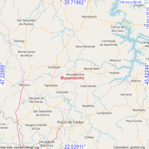
Muzambinho GPS coordinates[2]
21° 22' 32.988" South, 46° 31' 32.016" West
| Map corner | latitude | longitude |
|---|---|---|
| Upper-left | -20.71962°, | -47.22869° |
| Center: | -21.37583°, | -46.52556° |
| Lower-right: | -22.02911°, | -45.82244° |
| Map W x H: | 145.6×145.6 km | = 90.5×90.5mi |
| max Lat: | 2.81972° ⇑65.8% North |
| Muzambinho: | -21.37583° |
| min Lat: | ⇓34.2% South -33.69111° |
| min Long | Muzambinho | max Long |
| -72.89583° | -46.52556° | -32.41083° |
| W 45.1%⇐ | ⇒54.9% E |
Elevation
Elevation of Muzambinho is 1044 m = 3425 ft, and this is 663.1 m = 2176 ft above average elevation for this country.
| Max E: |
1603 m = 5259 ft | 1.1% |
| Muzambinho | 1044 m 3425 ft | |
| Avg. | 380.9 m = 1250 ft | |
Min E: |
0 m = 0 ft | 98.9% |
See also: Brazil elevation on elevation.city.
Geographical zone
Muzambinho is located in South Torrid zone (between Equator and Tropic of Capricorn). Distance of this Southern Tropic circle is 229.1 km =142.4 mi to South.| Distance of | km | miles | from Muzambinho |
|---|---|---|---|
| Equator | 2376.8 | 1476.9 | to North |
| Tropic Capricorn | 229.1 | 142.4 | to South |
| Antarctic Circle | 5024.4 | 3122 | to South |
| South Pole | 7630.3 | 4741.2 | to South |


Nearby cities:
15 places around Muzambinho: (largest is in red/bold)
• Alfenas
60.2 km =37.4 mi,  95°
95°
• Alpinópolis
58.7 km =36.5 mi,  14°
14°
• Alterosa
42 km =26.1 mi,  70°
70°
• Areado
39.4 km =24.5 mi,  87°
87°
• Botelhos
31.7 km =19.7 mi,  154°
154°
• Caconde
21 km =13 mi,  215°
215°
• Campestre
47.2 km =29.3 mi,  142°
142°
• Carmo do Rio Claro
61.6 km =38.3 mi,  43°
43°
• Guaranésia
29.9 km =18.6 mi,  286°
286°
• Guaxupé
20.9 km =13 mi, 292°
• Mococa
50.6 km =31.4 mi,  258°
258°
• Monte Santo de Minas
51.5 km =32 mi, 293°
• Poços de Caldas
46 km =28.6 mi,  184°
184°
• São José do Rio Pardo
44.8 km =27.8 mi,  236°
236°
• Vargem Grande do Sul
63.4 km =39.4 mi, 216°
Sources, notices
• [Note1] Compared only with cities in Brazil existing in our database
• [Src1] Map data: © OpenStreetMap contributors (CC-BY-SA)
• [Src2] Other city data from geonames.org with taken over terms of usage.
• [Src3] Geographical zone / Annual Mean Temperature by Robert A. Rohde @ Wikipedia
