Alterosa geodata
Alterosa (Minas Gerais) is a populated place; located in Brazil in America/Sao_Paulo (GMT-3) time zone. With population of 9,277 people, there are 1703 cities with bigger population in this country. Compared to other cities in Brazil, 65% of cities are located further ↑North; 53% of cities are located further →East and 91.4% of cities have lower elevation than Alterosa. Note1


Alterosa GPS coordinates[2]
21° 14' 57.012" South, 46° 8' 35.016" West
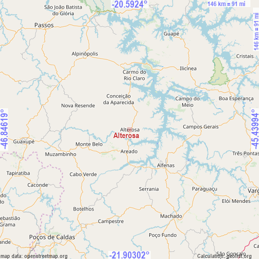
| Map corner | latitude | longitude |
|---|---|---|
| Upper-left | -20.5924°, | -46.84619° |
| Center: | -21.24917°, | -46.14306° |
| Lower-right: | -21.90302°, | -45.43994° |
| Map W x H: | 145.7×145.7 km | = 90.5×90.5mi |
| max Lat: | 2.81972° ⇑65% North |
| Alterosa: | -21.24917° |
| min Lat: | ⇓35% South -33.69111° |
| min Long | Alterosa | max Long |
| -72.89583° | -46.14306° | -32.41083° |
| W 47%⇐ | ⇒53% E |
Elevation
Elevation of Alterosa is 836 m = 2743 ft, and this is 455.1 m = 1493 ft above average elevation for this country.
| Max E: |
1603 m = 5259 ft | 8.6% |
| Alterosa | 836 m 2743 ft | |
| Avg. | 380.9 m = 1250 ft | |
Min E: |
0 m = 0 ft | 91.4% |
See also: Brazil elevation on elevation.city.
Geographical zone
Alterosa is located in South Torrid zone (between Equator and Tropic of Capricorn). Distance of this Southern Tropic circle is 243.2 km =151.1 mi to South.| Distance of | km | miles | from Alterosa |
|---|---|---|---|
| Equator | 2362.7 | 1468.1 | to North |
| Tropic Capricorn | 243.2 | 151.1 | to South |
| Antarctic Circle | 5038.5 | 3130.8 | to South |
| South Pole | 7644.4 | 4750 | to South |


Nearby cities:
15 places around Alterosa: (largest is in red/bold)
• Alfenas
28.5 km =17.7 mi,  134°
134°
• Alpinópolis
49.8 km =30.9 mi,  329°
329°
• Areado
12.2 km =7.6 mi,  181°
181°
• Boa Esperança
62.4 km =38.8 mi,  73°
73°
• Botelhos
50 km =31.1 mi,  211°
211°
• Caconde
60.5 km =37.6 mi,  238°
238°
• Campestre
52.5 km =32.6 mi,  191°
191°
• Campos Gerais
39.9 km =24.8 mi,  87°
87°
• Carmo do Rio Claro
30.9 km =19.2 mi,  4°
4°
• Guaranésia
68.6 km =42.6 mi,  265°
265°
• Guaxupé
59.4 km =36.9 mi,  263°
263°
• Machado
52.7 km =32.7 mi,  153°
153°
• Muzambinho
42 km =26.1 mi,  250°
250°
• Paraguaçu
53.5 km =33.2 mi, 128°
• Três Pontas
66.6 km =41.4 mi,  101°
101°
Sources, notices
• [Note1] Compared only with cities in Brazil existing in our database
• [Src1] Map data: © OpenStreetMap contributors (CC-BY-SA)
• [Src2] Other city data from geonames.org with taken over terms of usage.
• [Src3] Geographical zone / Annual Mean Temperature by Robert A. Rohde @ Wikipedia
