Marechal Floriano geodata
Marechal Floriano (Espírito Santo) is a populated place; located in Brazil in America/Sao_Paulo (GMT-3) time zone. With population of 5,869 people, there are 1882 cities with bigger population in this country. Compared to other cities in Brazil, 59.4% of cities are located further ↑North; 71.6% of cities are located further ←West and 67.7% of cities have lower elevation than Marechal Floriano. Note1


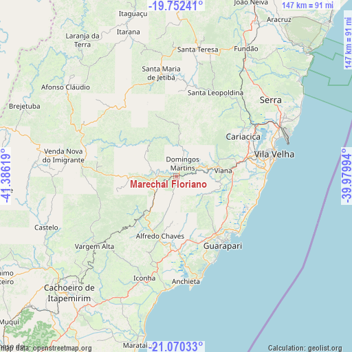
Marechal Floriano GPS coordinates[2]
20° 24' 46.008" South, 40° 40' 59.016" West
| Map corner | latitude | longitude |
|---|---|---|
| Upper-left | -19.75241°, | -41.38619° |
| Center: | -20.41278°, | -40.68306° |
| Lower-right: | -21.07033°, | -39.97994° |
| Map W x H: | 146.5×146.5 km | = 91×91mi |
| max Lat: | 2.81972° ⇑59.4% North |
| Marechal Floriano: | -20.41278° |
| min Lat: | ⇓40.6% South -33.69111° |
| min Long | Marechal Floria | max Long |
| -72.89583° | -40.68306° | -32.41083° |
| W 71.6%⇐ | ⇒28.4% E |
Elevation
Elevation of Marechal Floriano is 555 m = 1821 ft, and this is 174.1 m = 571 ft above average elevation for this country.
| Max E: |
1603 m = 5259 ft | 32.3% |
| Marechal Floriano | 555 m 1821 ft | |
| Avg. | 380.9 m = 1250 ft | |
Min E: |
0 m = 0 ft | 67.7% |
See also: Brazil elevation on elevation.city.
Geographical zone
Marechal Floriano is located in South Torrid zone (between Equator and Tropic of Capricorn). Distance of this Southern Tropic circle is 336.2 km =208.9 mi to South.| Distance of | km | miles | from Marechal Floriano |
|---|---|---|---|
| Equator | 2269.7 | 1410.3 | to North |
| Tropic Capricorn | 336.2 | 208.9 | to South |
| Antarctic Circle | 5131.5 | 3188.6 | to South |
| South Pole | 7737.4 | 4807.8 | to South |


Nearby cities:
15 places around Marechal Floriano: (largest is in red/bold)
• Alfredo Chaves
25.7 km =16 mi,  195°
195°
• Castelo
56.4 km =35 mi,  247°
247°
• Domingos Martins
6 km =3.7 mi,  24°
24°
• Guarapari
34.4 km =21.4 mi,  146°
146°
• Iconha
44.3 km =27.5 mi, 197°
• Jetibá
43.6 km =27.1 mi,  0°
0°
• Piúma
47.4 km =29.5 mi,  184°
184°
• Santa Leopoldina
38.2 km =23.7 mi, 24°
• Santa Maria de Jetibá
43.3 km =26.9 mi,  351°
351°
• Santa Teresa
53.8 km =33.4 mi,  9°
9°
• Serra
50.3 km =31.3 mi,  51°
51°
• Vargem Alta
44.3 km =27.5 mi,  229°
229°
• Viana
19.6 km =12.2 mi,  82°
82°
• Vila Velha
41.7 km =25.9 mi, 77°
• Vitória
37.5 km =23.3 mi,  73°
73°
Sources, notices
• [Note1] Compared only with cities in Brazil existing in our database
• [Src1] Map data: © OpenStreetMap contributors (CC-BY-SA)
• [Src2] Other city data from geonames.org with taken over terms of usage.
• [Src3] Geographical zone / Annual Mean Temperature by Robert A. Rohde @ Wikipedia
