Jacutinga geodata
Jacutinga (Minas Gerais) is a populated place; located in Brazil in America/Sao_Paulo (GMT-3) time zone. With population of 18,469 people, there are 1012 cities with bigger population in this country. Compared to other cities in Brazil, 71.8% of cities are located further ↑North; 55.6% of cities are located further →East and 91.9% of cities have lower elevation than Jacutinga. Note1


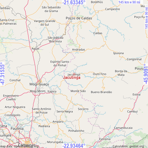
Jacutinga GPS coordinates[2]
22° 17' 8.016" South, 46° 36' 43.992" West
| Map corner | latitude | longitude |
|---|---|---|
| Upper-left | -21.63345°, | -47.31535° |
| Center: | -22.28556°, | -46.61222° |
| Lower-right: | -22.93464°, | -45.9091° |
| Map W x H: | 144.7×144.7 km | = 89.9×89.9mi |
| max Lat: | 2.81972° ⇑71.8% North |
| Jacutinga: | -22.28556° |
| min Lat: | ⇓28.2% South -33.69111° |
| min Long | Jacutinga | max Long |
| -72.89583° | -46.61222° | -32.41083° |
| W 44.4%⇐ | ⇒55.6% E |
Elevation
Elevation of Jacutinga is 842 m = 2762 ft, and this is 461.1 m = 1513 ft above average elevation for this country.
| Max E: |
1603 m = 5259 ft | 8.1% |
| Jacutinga | 842 m 2762 ft | |
| Avg. | 380.9 m = 1250 ft | |
Min E: |
0 m = 0 ft | 91.9% |
See also: Brazil elevation on elevation.city.
Geographical zone
Jacutinga is located in South Torrid zone (between Equator and Tropic of Capricorn). Distance of this Southern Tropic circle is 128 km =79.5 mi to South.| Distance of | km | miles | from Jacutinga |
|---|---|---|---|
| Equator | 2477.9 | 1539.7 | to North |
| Tropic Capricorn | 128 | 79.5 | to South |
| Antarctic Circle | 4923.3 | 3059.2 | to South |
| South Pole | 7529.1 | 4678.4 | to South |


Nearby cities:
15 places around Jacutinga: (largest is in red/bold)
• Aguaí
45.3 km =28.1 mi,  303°
303°
• Amparo
48.8 km =30.3 mi,  198°
198°
• Andradas
24.6 km =15.3 mi,  10°
10°
• Borda da Mata
46 km =28.6 mi,  88°
88°
• Bueno Brandão
31.9 km =19.8 mi,  122°
122°
• Espírito Santo do Pinhal
20.2 km =12.6 mi,  338°
338°
• Itapira
27.3 km =17 mi,  232°
232°
• Mogi Guaçu
35.5 km =22.1 mi,  255°
255°
• Mogi Mirim
39.1 km =24.3 mi,  245°
245°
• Monte Sião
16.8 km =10.4 mi,  165°
165°
• Santo Antônio de Posse
47.6 km =29.6 mi,  221°
221°
• Serra Negra
37.4 km =23.2 mi,  194°
194°
• Socorro
35.1 km =21.8 mi, 165°
• São João da Boa Vista
40 km =24.9 mi,  331°
331°
• Águas de Lindóia
21.3 km =13.2 mi, 185°
Sources, notices
• [Note1] Compared only with cities in Brazil existing in our database
• [Src1] Map data: © OpenStreetMap contributors (CC-BY-SA)
• [Src2] Other city data from geonames.org with taken over terms of usage.
• [Src3] Geographical zone / Annual Mean Temperature by Robert A. Rohde @ Wikipedia
