Jacarezinho geodata
Jacarezinho (Paraná) is a populated place; located in Brazil in America/Sao_Paulo (GMT-3) time zone. With population of 35,090 people, there are 585 cities with bigger population in this country. Compared to other cities in Brazil, 80% of cities are located further ↑North; 78.1% of cities are located further →East and 57.6% of cities have lower elevation than Jacarezinho. Note1


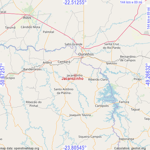
Jacarezinho GPS coordinates[2]
23° 9' 38.016" South, 49° 58' 9.984" West
| Map corner | latitude | longitude |
|---|---|---|
| Upper-left | -22.51255°, | -50.67257° |
| Center: | -23.16056°, | -49.96944° |
| Lower-right: | -23.80545°, | -49.26632° |
| Map W x H: | 143.8×143.8 km | = 89.4×89.4mi |
| max Lat: | 2.81972° ⇑80% North |
| Jacarezinho: | -23.16056° |
| min Lat: | ⇓20% South -33.69111° |
| min Long | Jacarezinho | max Long |
| -72.89583° | -49.96944° | -32.41083° |
| W 21.9%⇐ | ⇒78.1% E |
Elevation
Elevation of Jacarezinho is 448 m = 1470 ft, and this is 67.1 m = 220 ft above average elevation for this country.
| Max E: |
1603 m = 5259 ft | 42.4% |
| Jacarezinho | 448 m 1470 ft | |
| Avg. | 380.9 m = 1250 ft | |
Min E: |
0 m = 0 ft | 57.6% |
See also: Brazil elevation on elevation.city.
Geographical zone
Jacarezinho is located in South Torrid zone (between Equator and Tropic of Capricorn). Distance of this Southern Tropic circle is 30.7 km =19.1 mi to South.| Distance of | km | miles | from Jacarezinho |
|---|---|---|---|
| Equator | 2575.2 | 1600.2 | to North |
| Tropic Capricorn | 30.7 | 19.1 | to South |
| Antarctic Circle | 4826 | 2998.7 | to South |
| South Pole | 7431.8 | 4617.9 | to South |


Nearby cities:
15 places around Jacarezinho: (largest is in red/bold)
• Assis
71.6 km =44.5 mi,  320°
320°
• Bandeirantes
41.1 km =25.5 mi,  277°
277°
• Bernardino de Campos
53.2 km =33.1 mi,  72°
72°
• Cambará
16.6 km =10.3 mi, 319°
• Chavantes
29.8 km =18.5 mi,  63°
63°
• Cornélio Procópio
69.3 km =43.1 mi,  268°
268°
• Cândido Mota
62.8 km =39 mi, 317°
• Fartura
53.3 km =33.1 mi,  118°
118°
• Ipauçu
36.9 km =22.9 mi, 71°
• Ourinhos
22.6 km =14 mi,  26°
26°
• Palmital
48.5 km =30.1 mi,  328°
328°
• Piraju
60 km =37.3 mi,  93°
93°
• Santa Cruz do Rio Pardo
45.1 km =28 mi,  49°
49°
• Santo Antônio da Platina
18.6 km =11.6 mi,  216°
216°
• Siqueira Campos
60.4 km =37.5 mi,  166°
166°
Sources, notices
• [Note1] Compared only with cities in Brazil existing in our database
• [Src1] Map data: © OpenStreetMap contributors (CC-BY-SA)
• [Src2] Other city data from geonames.org with taken over terms of usage.
• [Src3] Geographical zone / Annual Mean Temperature by Robert A. Rohde @ Wikipedia
