Charqueada geodata
Charqueada (São Paulo) is a populated place; located in Brazil in America/Sao_Paulo (GMT-3) time zone. With population of 12,391 people, there are 1437 cities with bigger population in this country. Compared to other cities in Brazil, 73.9% of cities are located further ↑North; 63.4% of cities are located further →East and 73.4% of cities have lower elevation than Charqueada. Note1


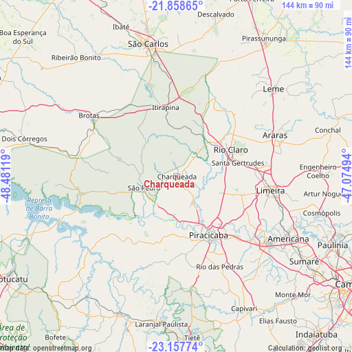
Charqueada GPS coordinates[2]
22° 30' 34.992" South, 47° 46' 41.016" West
| Map corner | latitude | longitude |
|---|---|---|
| Upper-left | -21.85865°, | -48.48119° |
| Center: | -22.50972°, | -47.77806° |
| Lower-right: | -23.15774°, | -47.07494° |
| Map W x H: | 144.4×144.4 km | = 89.7×89.7mi |
| max Lat: | 2.81972° ⇑73.9% North |
| Charqueada: | -22.50972° |
| min Lat: | ⇓26.1% South -33.69111° |
| min Long | Charqueada | max Long |
| -72.89583° | -47.77806° | -32.41083° |
| W 36.6%⇐ | ⇒63.4% E |
Elevation
Elevation of Charqueada is 606 m = 1988 ft, and this is 225.1 m = 739 ft above average elevation for this country.
| Max E: |
1603 m = 5259 ft | 26.6% |
| Charqueada | 606 m 1988 ft | |
| Avg. | 380.9 m = 1250 ft | |
Min E: |
0 m = 0 ft | 73.4% |
See also: Brazil elevation on elevation.city.
Geographical zone
Charqueada is located in South Torrid zone (between Equator and Tropic of Capricorn). Distance of this Southern Tropic circle is 103.1 km =64.1 mi to South.| Distance of | km | miles | from Charqueada |
|---|---|---|---|
| Equator | 2502.8 | 1555.2 | to North |
| Tropic Capricorn | 103.1 | 64.1 | to South |
| Antarctic Circle | 4898.3 | 3043.7 | to South |
| South Pole | 7504.2 | 4662.9 | to South |


Nearby cities:
15 places around Charqueada: (largest is in red/bold)
• Americana
52.5 km =32.6 mi,  119°
119°
• Araras
43.9 km =27.3 mi,  67°
67°
• Brotas
43.7 km =27.2 mi,  304°
304°
• Cordeirópolis
33.2 km =20.6 mi,  84°
84°
• Iracemápolis
27.8 km =17.3 mi,  106°
106°
• Itirapina
28.9 km =18 mi,  350°
350°
• Leme
53.8 km =33.4 mi,  47°
47°
• Limeira
39.1 km =24.3 mi,  98°
98°
• Piracicaba
27.4 km =17 mi,  151°
151°
• Rio Claro
24.8 km =15.4 mi,  63°
63°
• Rio das Pedras
41.1 km =25.5 mi, 154°
• Santa Bárbara d'Oeste
46.2 km =28.7 mi,  125°
125°
• Santa Gertrudes
26.1 km =16.2 mi, 76°
• São Carlos
55.9 km =34.7 mi, 348°
• São Pedro
14.6 km =9.1 mi,  252°
252°
Sources, notices
• [Note1] Compared only with cities in Brazil existing in our database
• [Src1] Map data: © OpenStreetMap contributors (CC-BY-SA)
• [Src2] Other city data from geonames.org with taken over terms of usage.
• [Src3] Geographical zone / Annual Mean Temperature by Robert A. Rohde @ Wikipedia
