Flores da Cunha geodata
Flores da Cunha (Rio Grande do Sul) is a populated place; located in Brazil in America/Sao_Paulo (GMT-3) time zone. With population of 20,521 people, there are 921 cities with bigger population in this country. Compared to other cities in Brazil, 95.9% of cities are located further ↑North; 83.9% of cities are located further →East and 84.1% of cities have lower elevation than Flores da Cunha. Note1


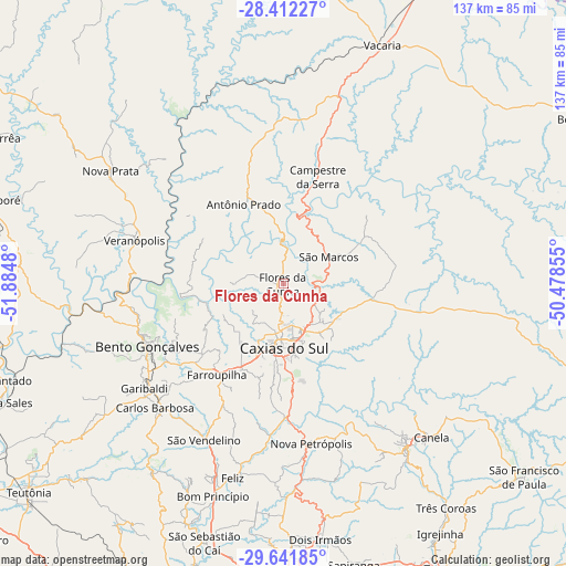
Flores da Cunha GPS coordinates[2]
29° 1' 44.004" South, 51° 10' 54.012" West
| Map corner | latitude | longitude |
|---|---|---|
| Upper-left | -28.41227°, | -51.8848° |
| Center: | -29.02889°, | -51.18167° |
| Lower-right: | -29.64185°, | -50.47855° |
| Map W x H: | 136.7×136.7 km | = 84.9×84.9mi |
| max Lat: | 2.81972° ⇑95.9% North |
| Flores da Cunha: | -29.02889° |
| min Lat: | ⇓4.1% South -33.69111° |
| min Long | Flores da Cunha | max Long |
| -72.89583° | -51.18167° | -32.41083° |
| W 16.1%⇐ | ⇒83.9% E |
Elevation
Elevation of Flores da Cunha is 748 m = 2454 ft, and this is 367.1 m = 1204 ft above average elevation for this country.
| Max E: |
1603 m = 5259 ft | 15.9% |
| Flores da Cunha | 748 m 2454 ft | |
| Avg. | 380.9 m = 1250 ft | |
Min E: |
0 m = 0 ft | 84.1% |
See also: Brazil elevation on elevation.city.
Geographical zone
Flores da Cunha is located in South temperate zone (between Tropic of Capricorn and the Antarctic Circle). Distance of this Southern Tropic circle is 621.8 km =386.4 mi to North.| Distance of | km | miles | from Flores da Cunha |
|---|---|---|---|
| Equator | 3227.7 | 2005.6 | to North |
| Tropic Capricorn | 621.8 | 386.4 | to North |
| Antarctic Circle | 4173.5 | 2593.3 | to South |
| South Pole | 6779.4 | 4212.5 | to South |


Nearby cities:
15 places around Flores da Cunha: (largest is in red/bold)
• Bento Gonçalves
36.4 km =22.6 mi,  244°
244°
• Canela
51 km =31.7 mi,  135°
135°
• Carlos Barbosa
43.2 km =26.8 mi,  226°
226°
• Caxias do Sul
15.5 km =9.6 mi,  179°
179°
• Estância Velha
68.9 km =42.8 mi, 179°
• Farroupilha
27.1 km =16.8 mi,  216°
216°
• Garibaldi
42.5 km =26.4 mi, 233°
• Ivoti
62.5 km =38.8 mi, 178°
• Nova Petrópolis
39.2 km =24.4 mi,  170°
170°
• Nova Prata
49.8 km =30.9 mi,  303°
303°
• São Marcos
12.8 km =8 mi,  59°
59°
• São Sebastião do Caí
64.8 km =40.3 mi,  196°
196°
• Três Coroas
66.9 km =41.6 mi, 144°
• Vacaria
62.3 km =38.7 mi,  22°
22°
• Veranópolis
37.2 km =23.1 mi,  286°
286°
Sources, notices
• [Note1] Compared only with cities in Brazil existing in our database
• [Src1] Map data: © OpenStreetMap contributors (CC-BY-SA)
• [Src2] Other city data from geonames.org with taken over terms of usage.
• [Src3] Geographical zone / Annual Mean Temperature by Robert A. Rohde @ Wikipedia
